From east- and westbound Interstate 90, take Exit 45
From Exit 45, turn left from eastbound/right from westbound onto Forest Road 9030 (road name may not be posted)
At 0.70 miles/1.10 km, stay left at the fork to proceed onto Forest Road 9031, as indicated by signage for the Ira Spring Trail
Proceed 3.60 miles/5.80 km to the parking lot at the end of the road
The pavement ends at 0.30 miles/0.50 km from the off-ramp and the remainder of the road is gravel and can be quite potholed
The Rainbow - Island Lakes Trail can also be accessed at its eastern junction with the Pratt Lake Trail. Follow directions to the Pratt Lake Trail and locate the junction at the Pratt Lake Saddle approximately 4.40 miles/7.10 km from the Pratt Lake trailhead, indicated by signage for Island Lake
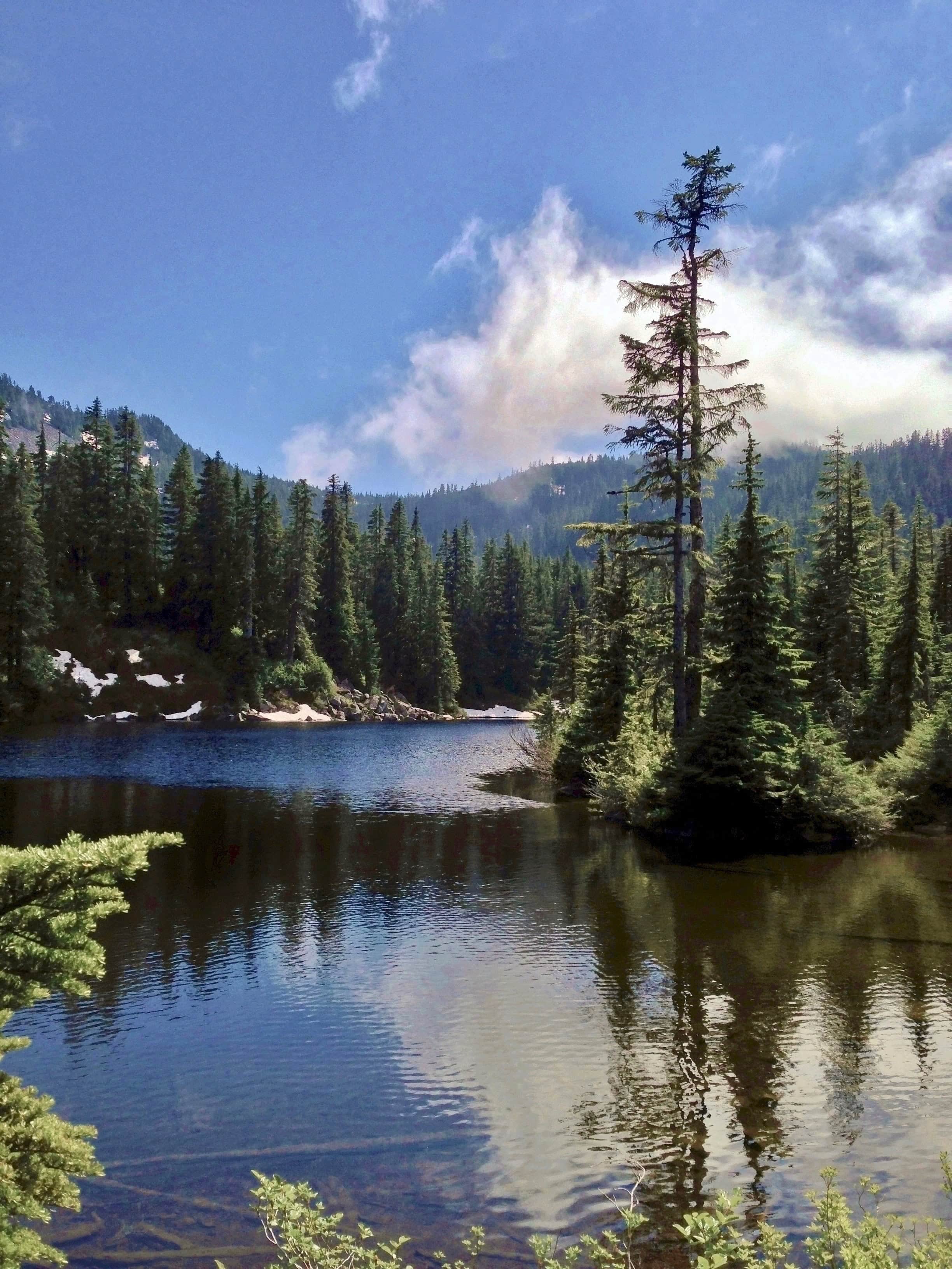
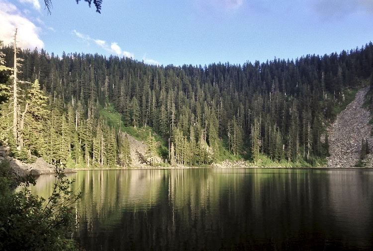
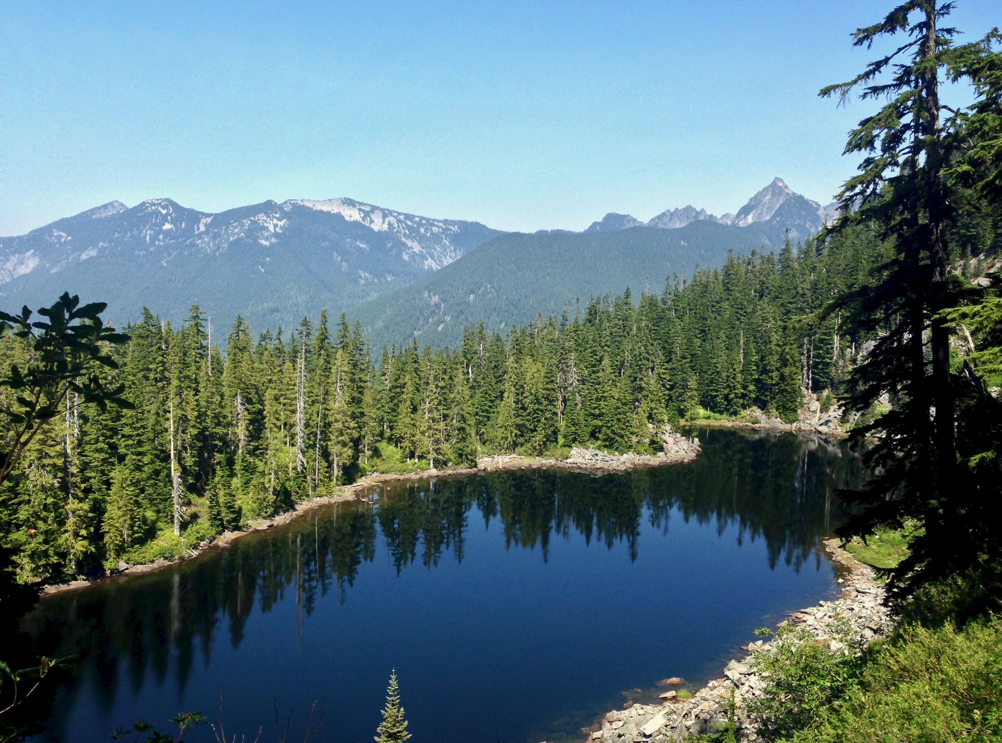
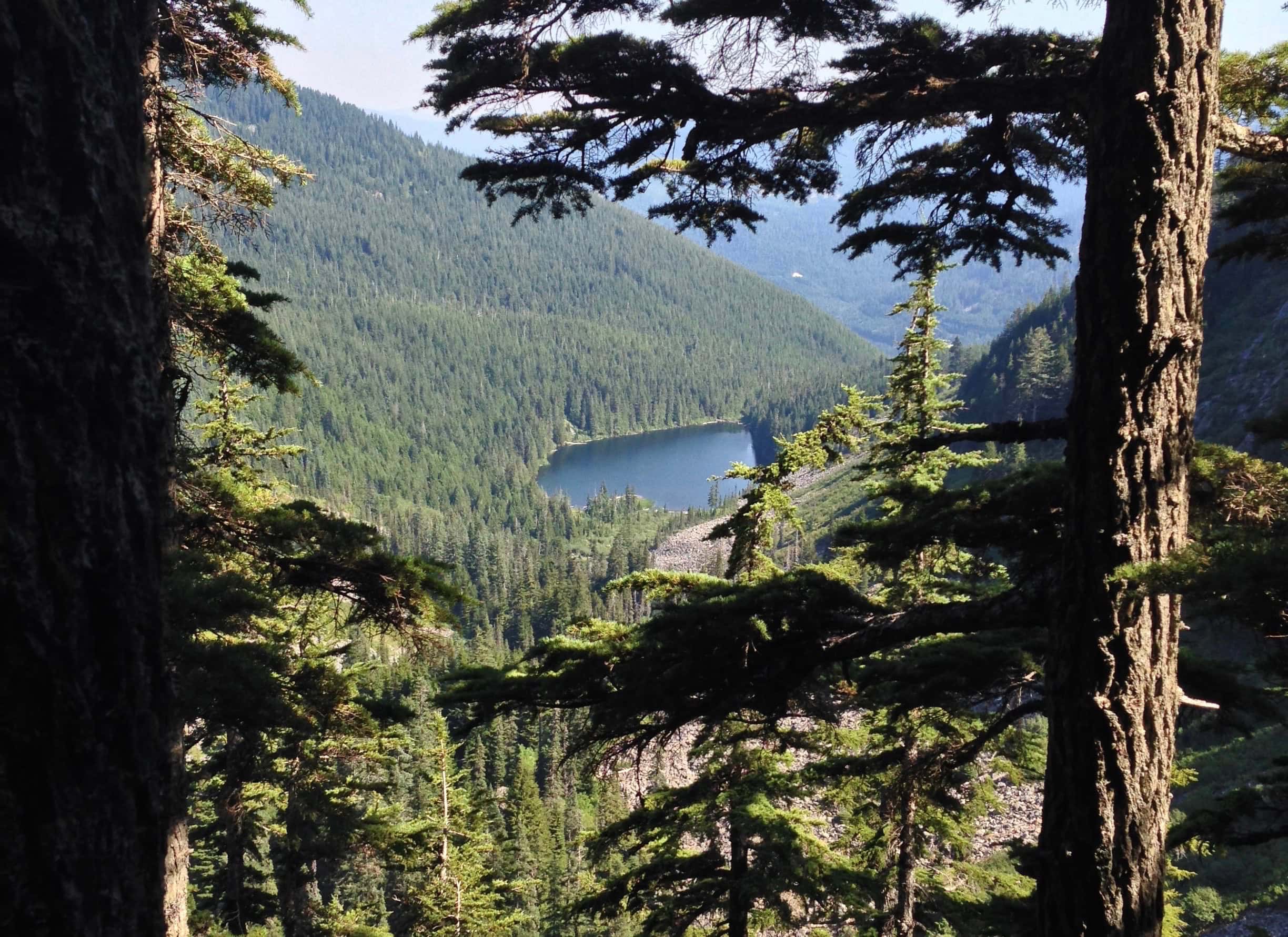
A water’s-edge sentinel stands guard over Rainbow Lake. Rainbow – Island Lakes Trail, July 04, 2013.
Several lakes in the southwest corner of the Alpine Lakes Wilderness, including Mason, Rainbow, and Island lakes, lie along the linked Ira Spring and Rainbow – Island Lakes trails that can be accessed from either end and by multiple trailheads. By whatever route, the trails traverse varied terrain that includes woodland, meadows, boulderfields, and, of course, the wilderness area’s namesake lakelands. Beyond the popular Mason Lake, the Ira Spring Trail connects to the much less travelled Rainbow – Island Lakes Trail, which offers a bit of backcountry quietude away from the crowds and the distant but constant rush of Interstate 90 that is common to many other trails along the South Fork Snoqualmie River Valley.
The western route to Mason, Rainbow, and Island lakes via the Ira Spring Trail, profiled here, crosses Bandera Mountain‘s lower, southern flank before continuing around to the lakes on its west and north. In quiet forest scarcely 0.25 miles/0.40 km beyond Mason Lake, the Ira Spring Trail ends at its junction with the Rainbow – Island Lakes Trail and the Mount Defiance Trail. Per signage at the junction, the Rainbow – Island Lakes Trail continues east through dense forest to another clutch of lakes between Pratt Mountain and Bandera Mountain.
The lakes can also be accessed farther east from the trails to Talapus Lake and Pratt Lake by crossing the Pratt Mountain Saddle and visiting the lakes in reverse order via the Rainbow – Island Lakes Trail. From the Talapus Lake trailhead, the round-trip to and from Mason Lake is 8.70 miles/14.00 km; via the Pratt Lake trailhead, the round-trip distance to and from Mason Lake is just slightly longer at 9.20 miles/14.80 km.
The Ira Spring Trail is named in honor of Ira Spring, a local nature photographer, author of numerous hiking guides, and advocate of wilderness preservation through public access. At a time when many argued that nature could only be conserved in the isolation of restricted access, Ira Spring was a leader in the creation of the well-developed and -maintained trail system enjoyed throughout Washington today.
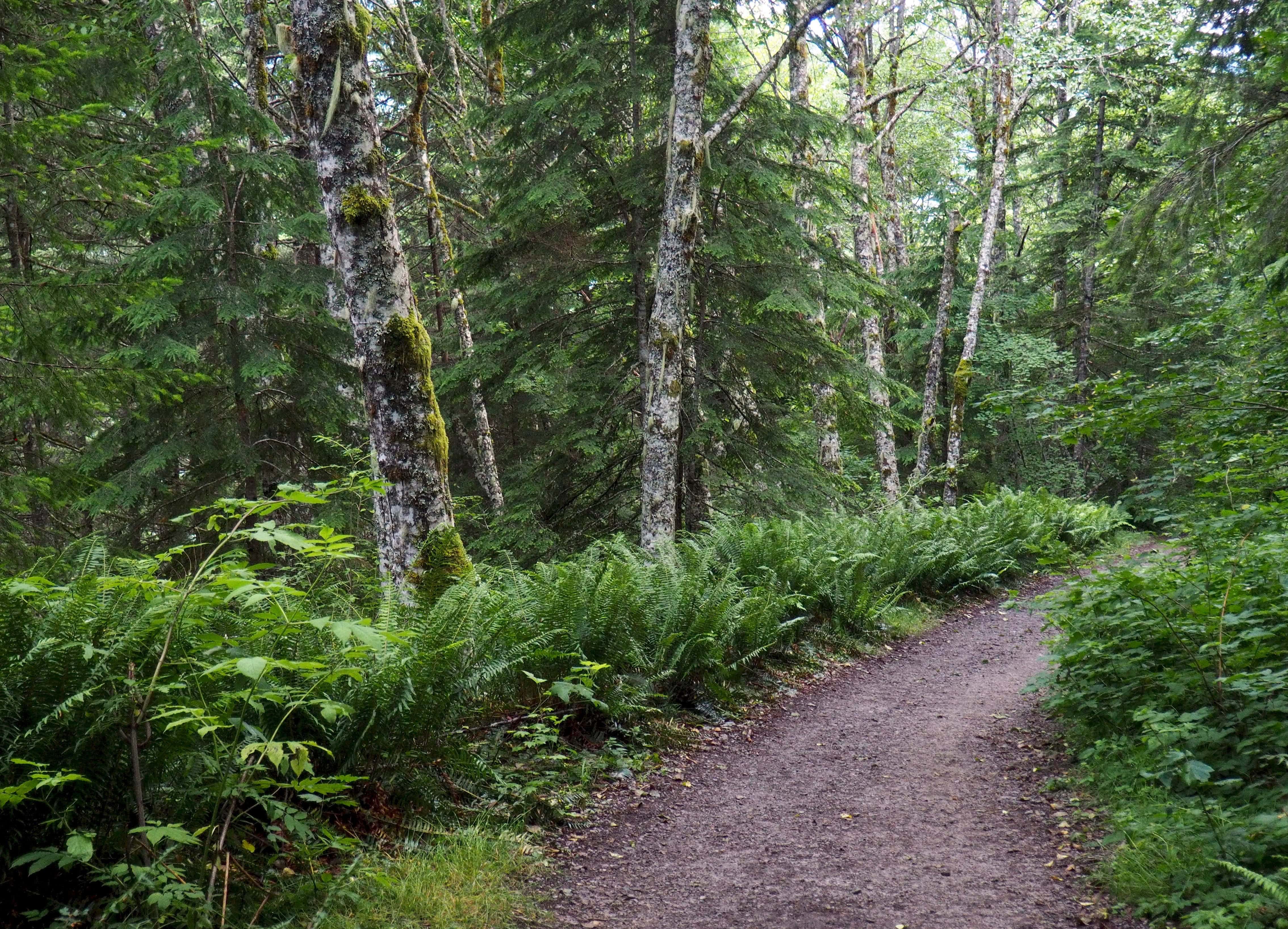
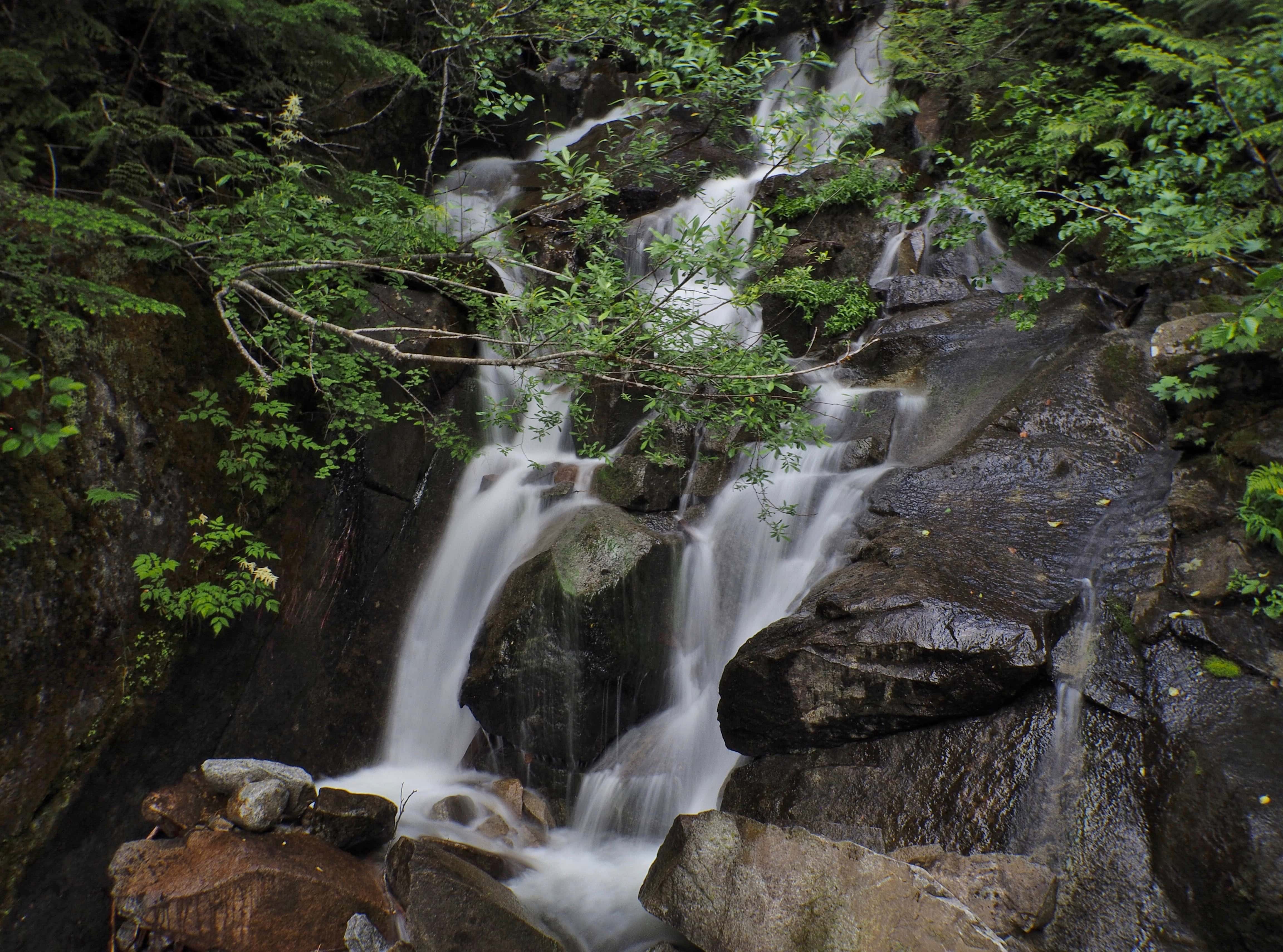
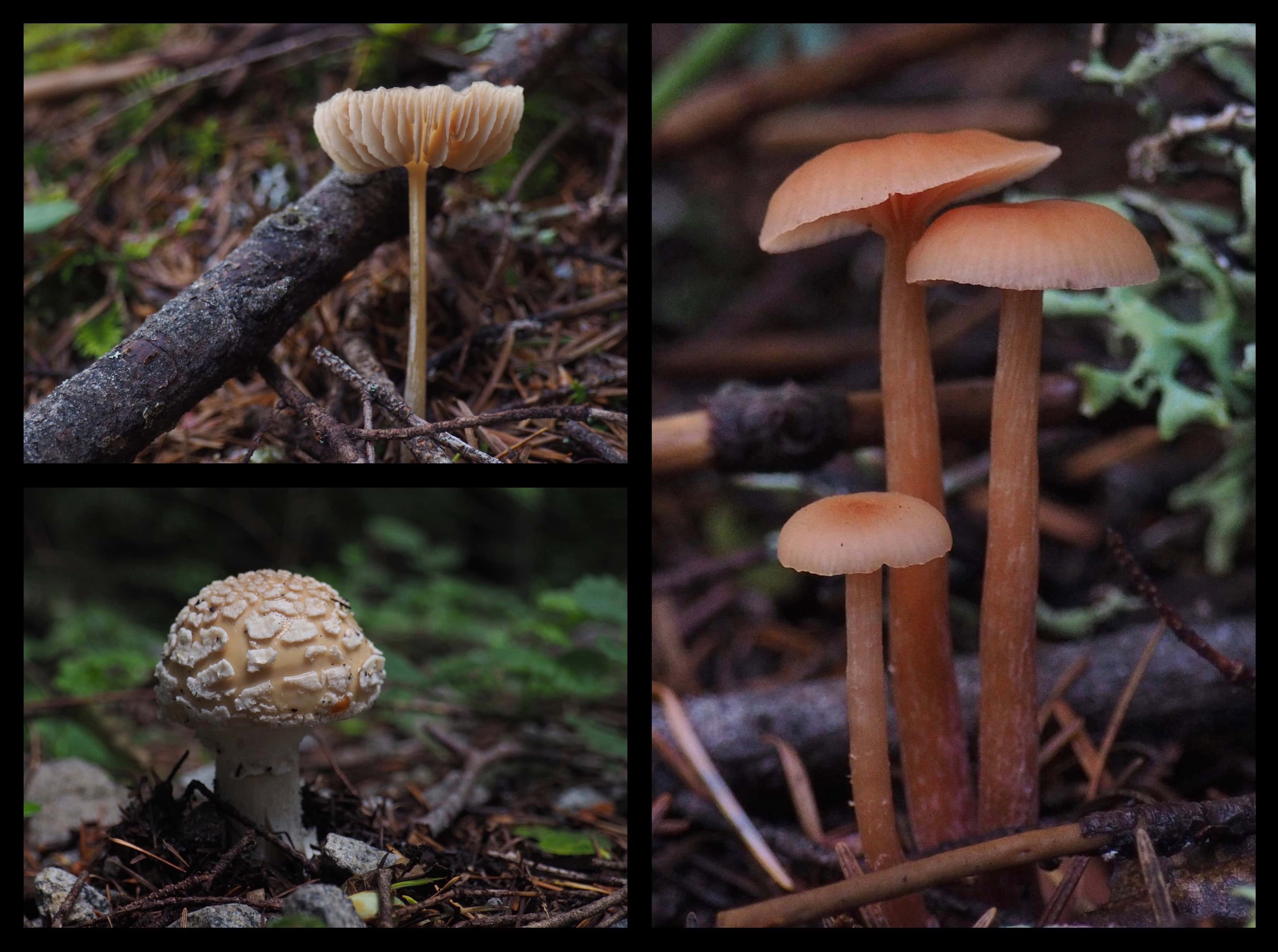
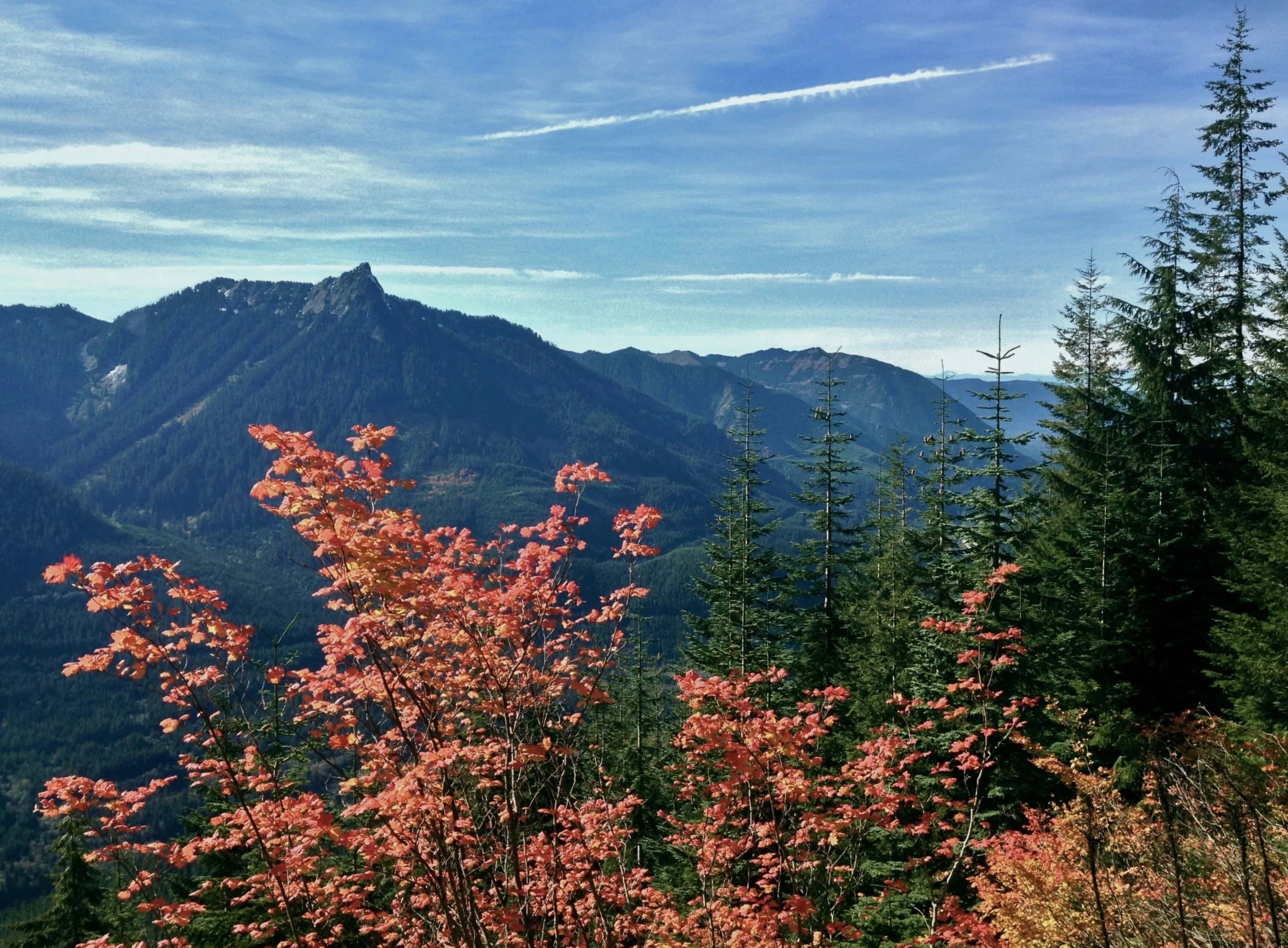
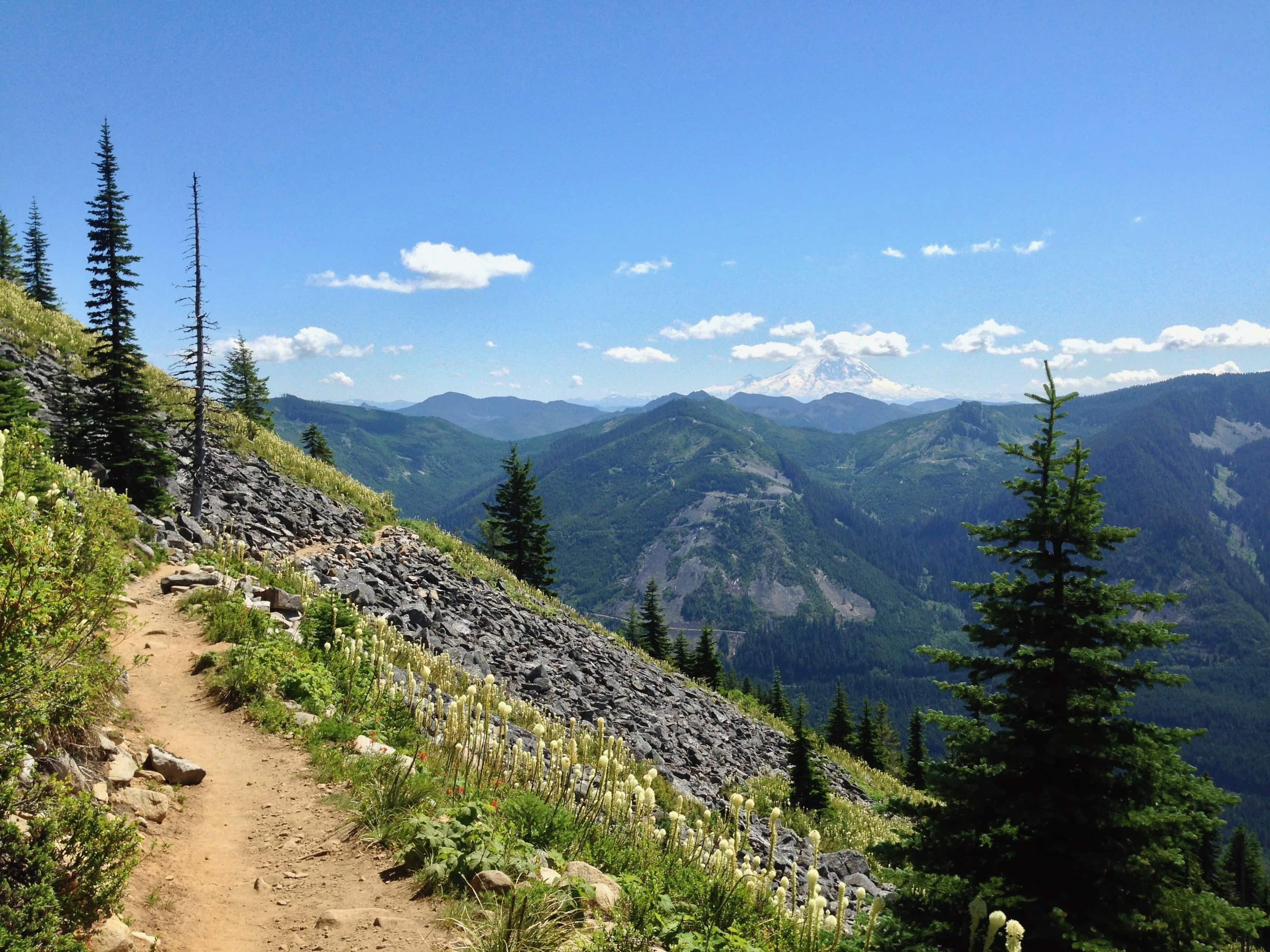
From its trailhead, the Ira Spring Trail begins gently enough on the remains of a fern-lined gravel road beneath dense, deciduous forest before veering steeply upward at approximately 1.60 miles/2.60 km from the trailhead. Ira Spring Trail, July 09, 2016.Spilling from Mason Lake high above, Mason Creek scampers beneath a sturdy log bridge approximately 0.80 miles/1.30 km from the trailhead. Ira Spring Trail, July 09, 2016.Watch for whimsically capped mushrooms posing here and there amongst the lowland forest litter. Ira Spring Trail, July 09, 2016.As the trail clears the forest, McClellan Butte’s distinctive pinnacle dominates the southwestern view from Bandera Mountain, here framed by the flaming autumn leaves of vine maple (Acer circinatum). Ira Spring Trail, October 05, 2013.Above the treeline, the trail flattens as it continues across Bandera Mountain‘s open flank, where a backward glance affords a picturesque glimpse of Mt. Rainier rising to the southeast. Ira Spring Trail, July 09, 2014.
Upon passing Bandera Mountain, the Ira Spring Trail enters the Alpine Lakes Wilderness, set aside by Congress for preservation in its natural state with minimal human imprint. (“A wilderness . . . is hereby recognized as an area where the earth and its community of life are untrammeled by man, where man himself is a visitor who does not remain.” Wilderness Act of 1964). While signing the act creating the Alpine Lakes Wilderness – against stiff opposition – U.S. President Gerald Ford reportedly commented “Anywhere so beautiful should be preserved.” And so it is. This corner of the Alpine Lakes Wilderness especially exemplifies its name, dotted everywhere with mountain lakes, ponds, and bogs.
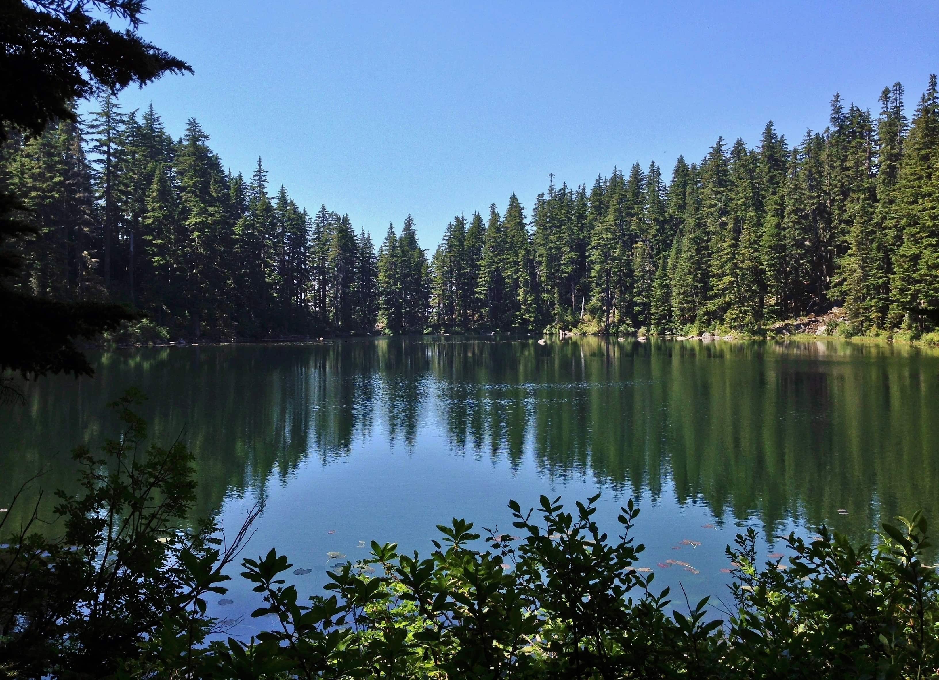
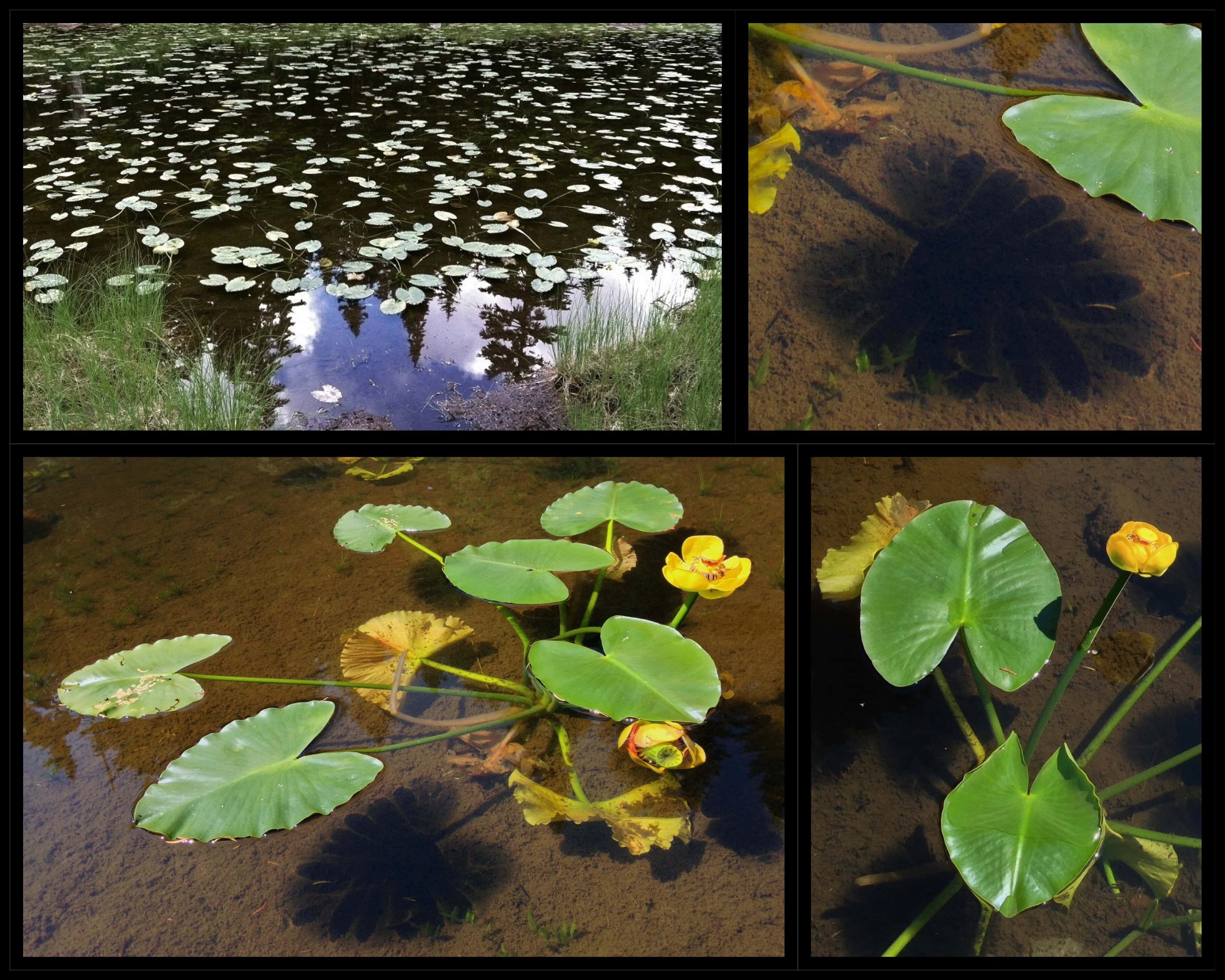
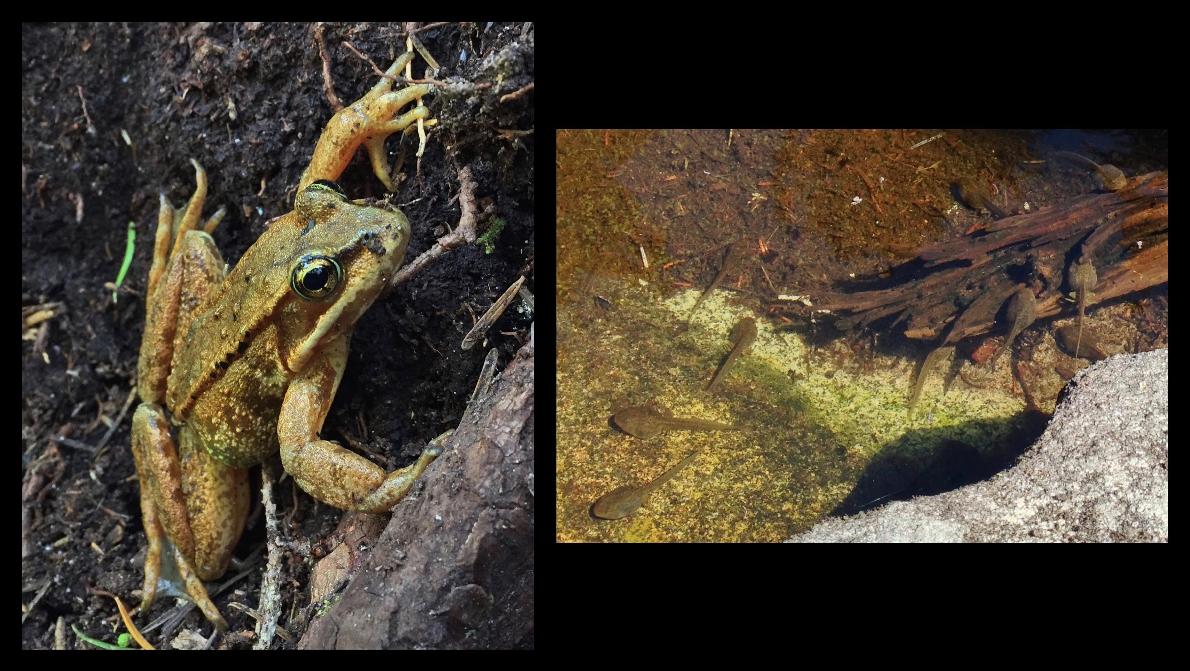
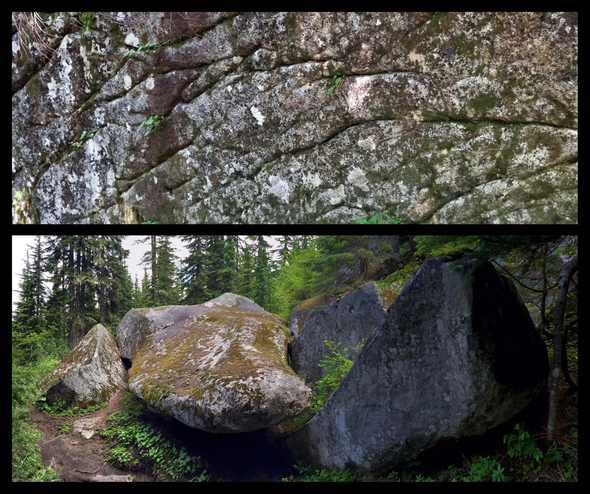
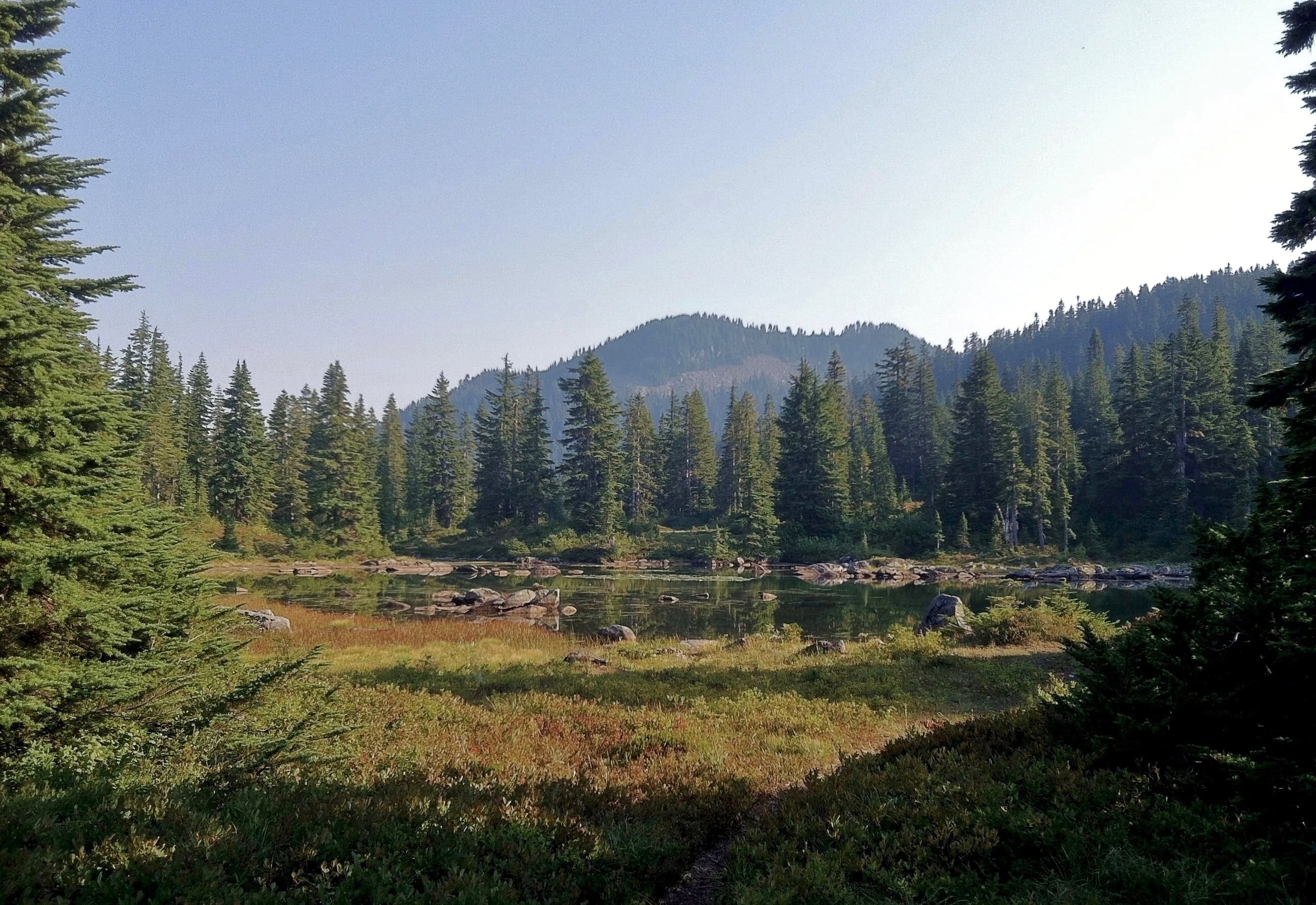
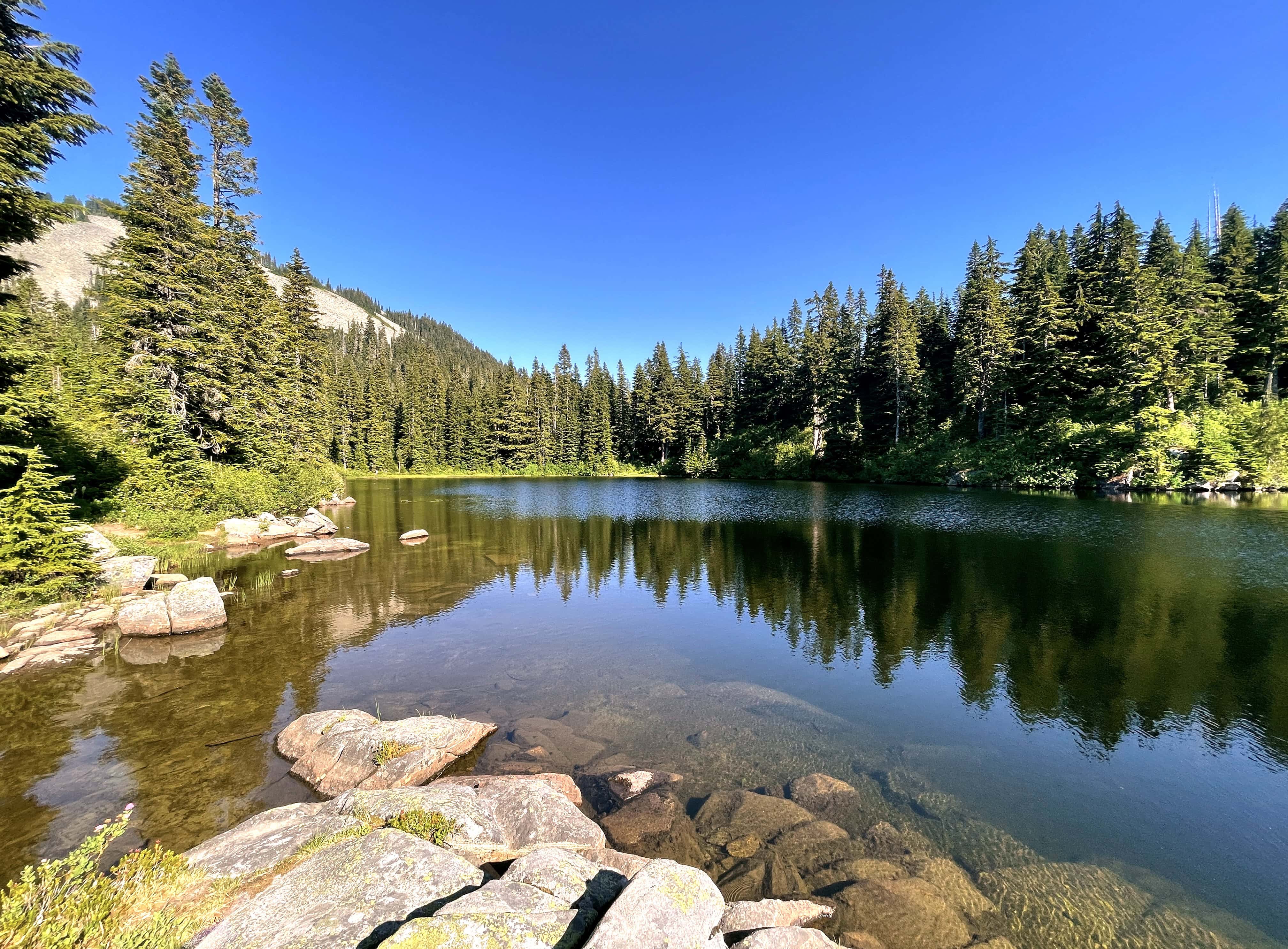
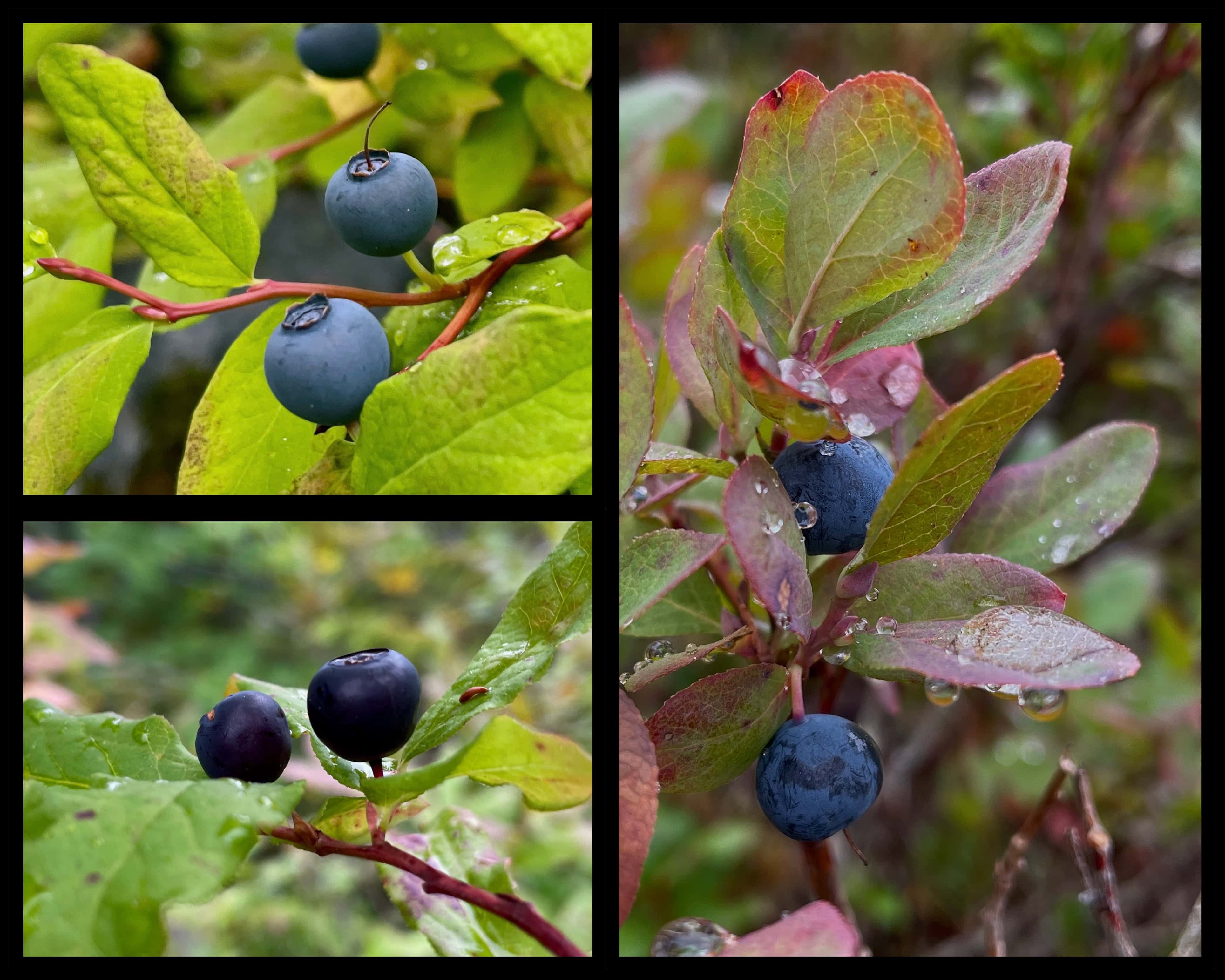
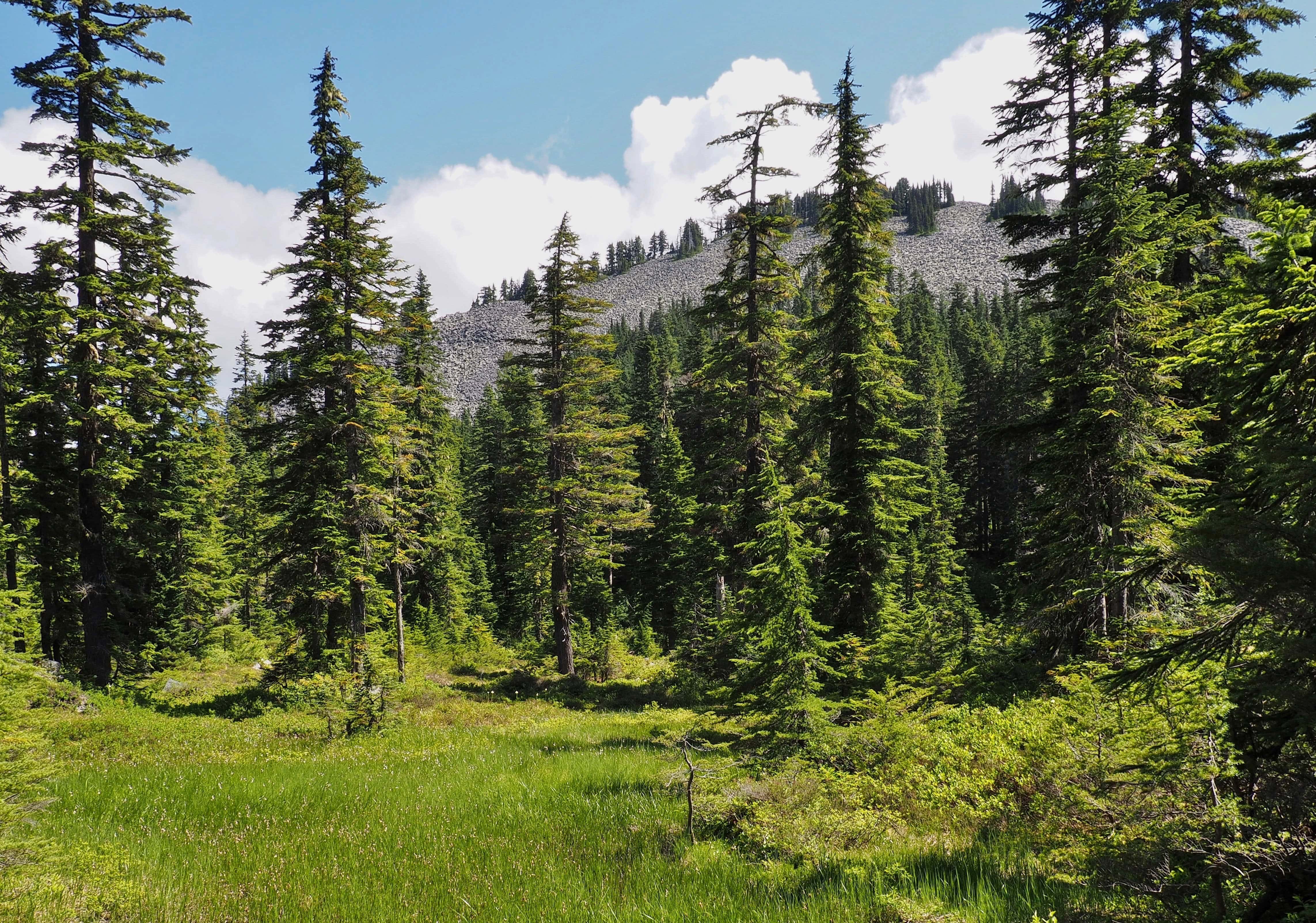
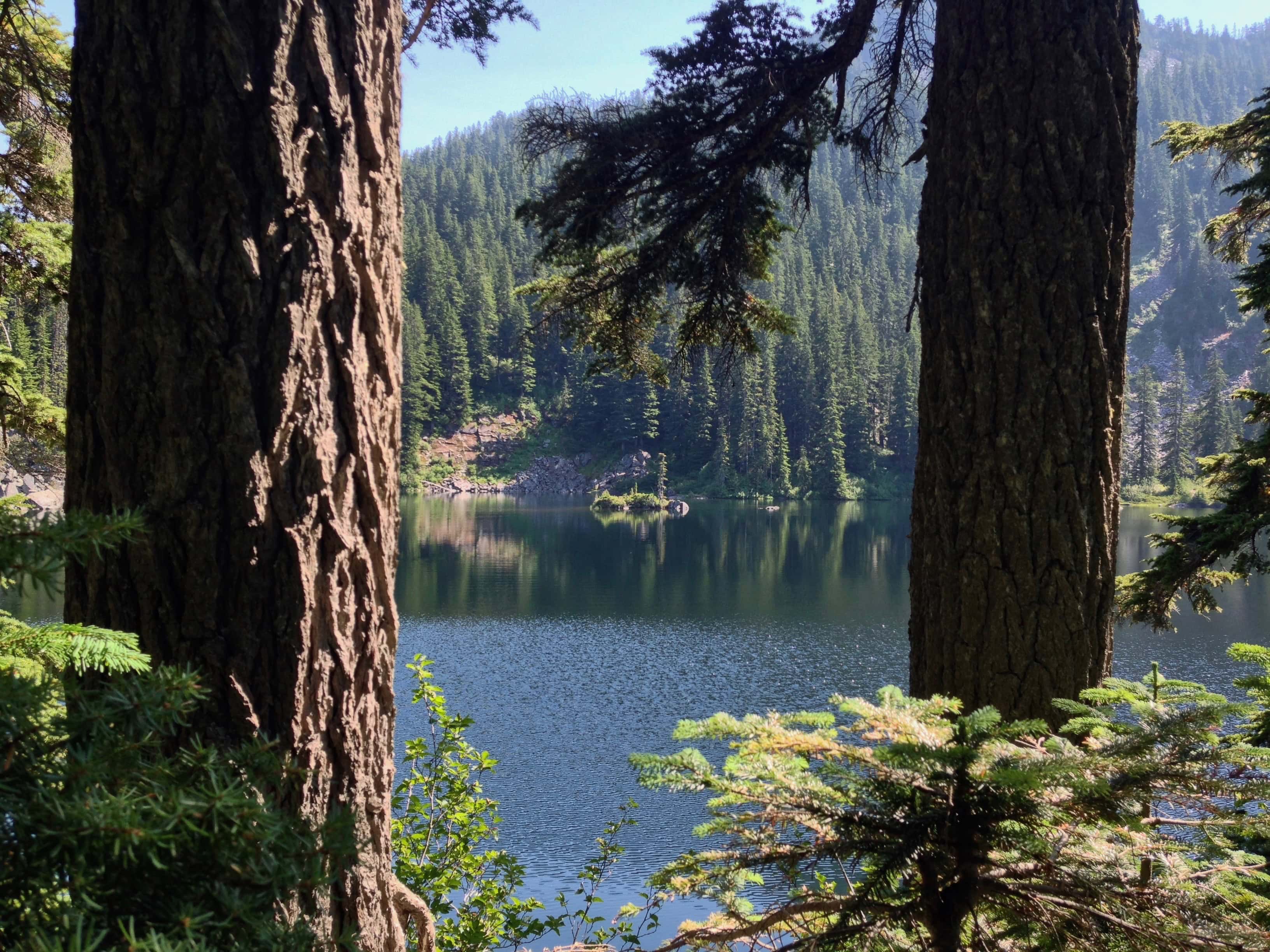
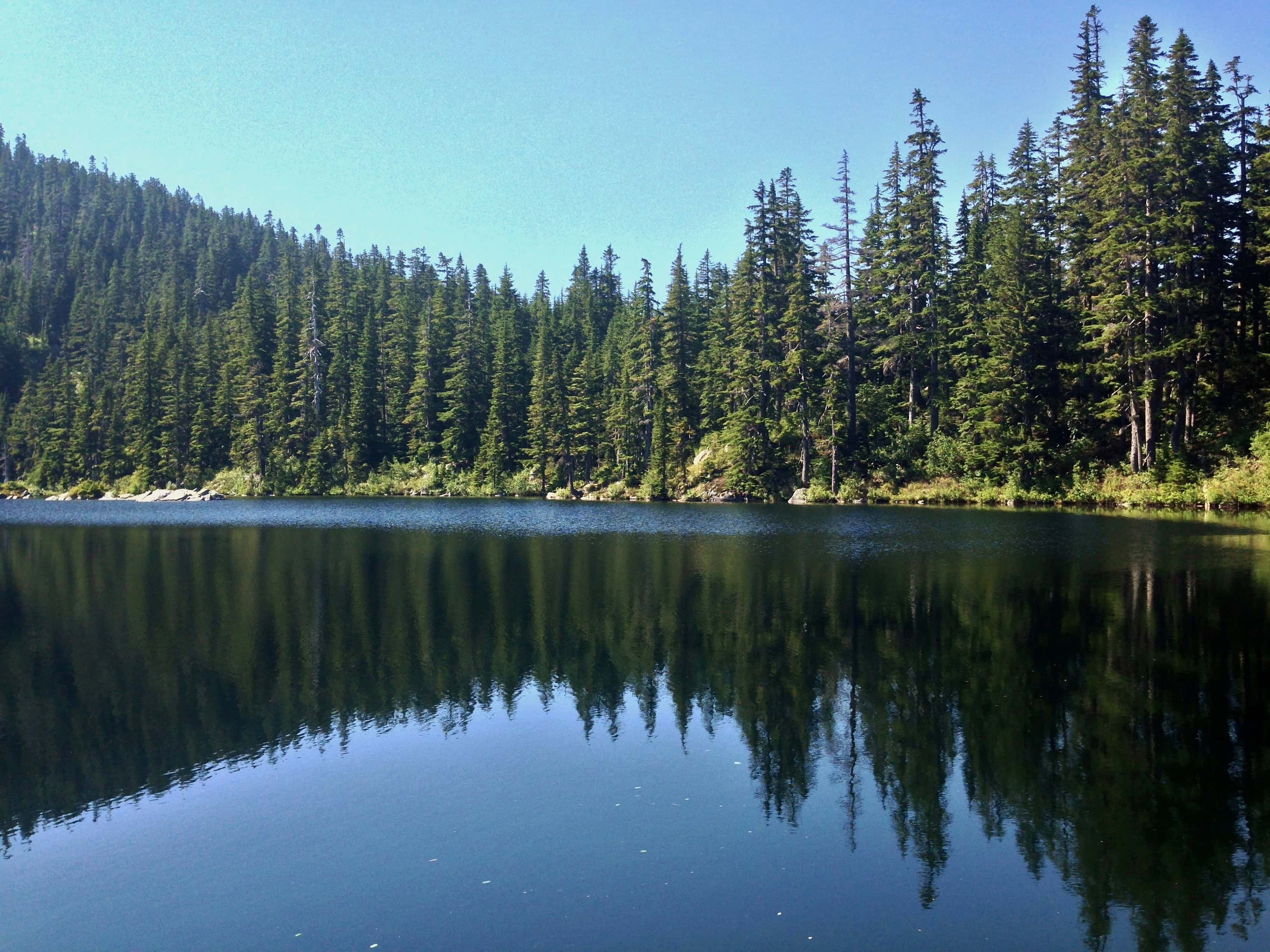
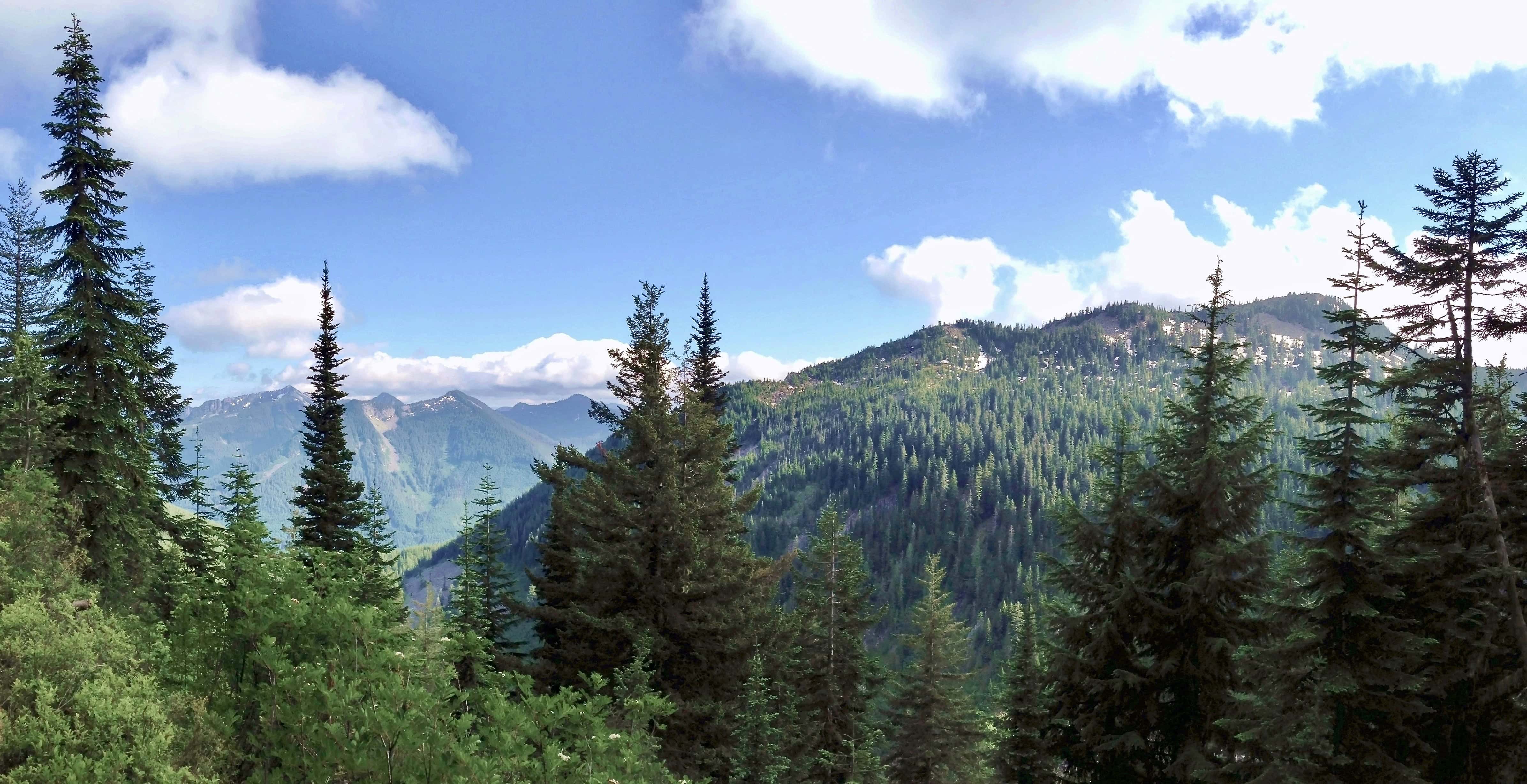
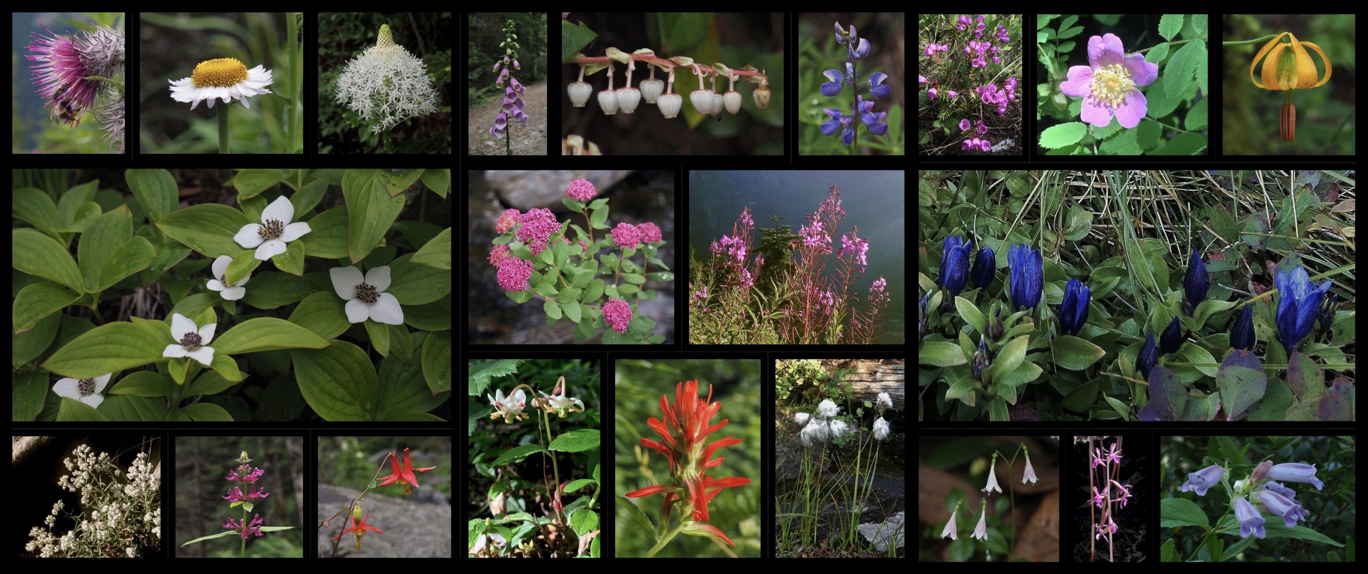
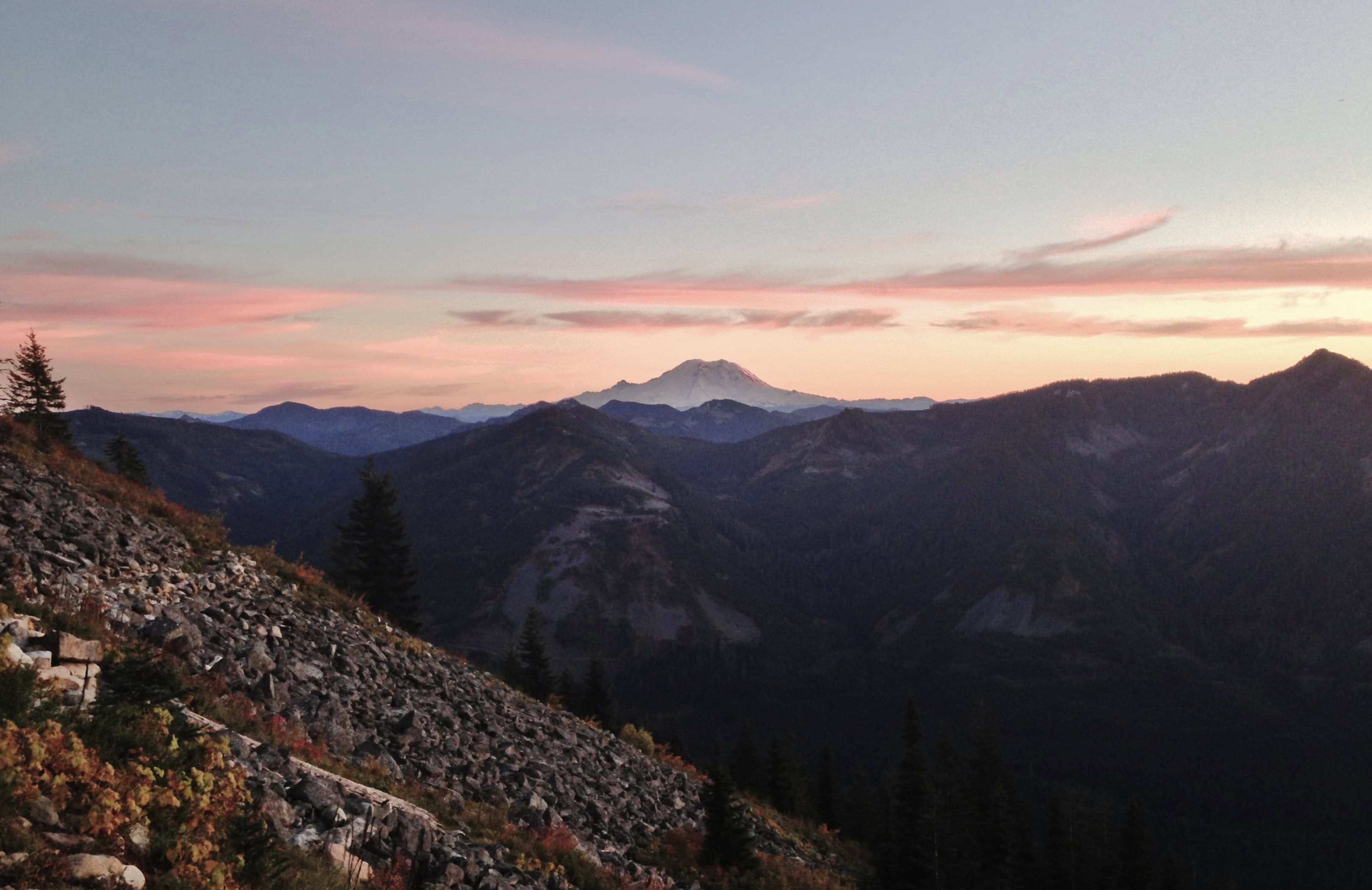
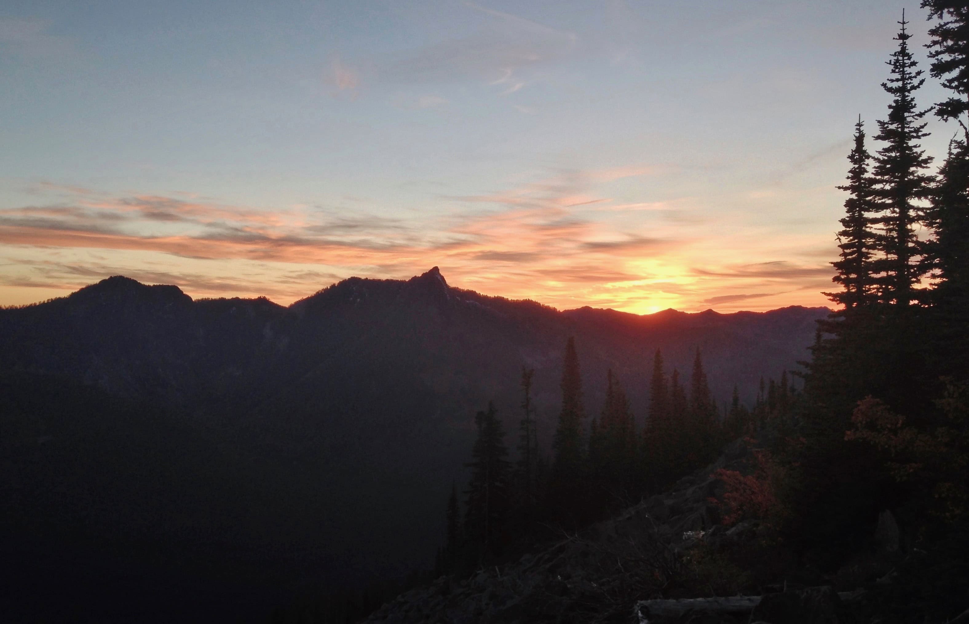
Mason Lake, here swathed in evening’s last light, is the first of several lakes encountered shortly after the Ira Spring Trail enters the Alpine Lakes Wilderness. Ira Spring Trail, August 18, 2013.From the Ira Spring Trail on Mason Lake’s northern shore, a 0.25-mile/0.40-km boot path leads through quiet, boggy wilds to Little Mason Lake. Ira Spring Trail, August 10, 2014.Ponds paved with the classic lily pad leaves and unusual blooms of the spatterdock, or, yellow pond lily (Nuphar polysepala) are a common feature of this corner of the Alpine Lakes Wilderness. Spatterdock lofts complex, squarish blooms above hovering leaves that cast X-ray-like shadows on the soft earth beneath the water’s surface. Ira Spring Trail, August 10, 2014.Frogs, here likely a Cascades frog (Rana cascadae), are abundant in the Alpine Lakes Wilderness, fattening lazily as tadpoles in its warm summer bogs, ponds, and shallow lakes. Ira Spring Trail, July 02, 2016 and August 10, 2014.Near the top of a ridge beyond the three-way Ira Spring/Rainbow – Island Lakes/Mount Defiance trail junction, look for a couple of geologic curiosities along the Rainbow – Island Lakes Trail. Folded creases in a natural rock wall along the trail suggest its formation from a less solid state eons ago. Atop the ridge, a seemingly out-of-place jumble of giant boulders forms a low, deep cave beside the trail, no doubt used for shelter on occasion by forest creatures. Rainbow – Island Lakes Trail, August 10, 2014 and July 17, 2016.Just after descending the ridge, the Ira Spring Trail rounds Sir Richard Pond, a charming, rock-lined lakelet set against the backdrop of Bandera Mountain. Rainbow – Island Lakes Trail, September 16, 2012.A scant 1.00 mile/1.60 km from Sir Richard Pond, the trail crosses a couple of boggy, frog-rife streams. A barely visible boot path follows the second outlet stream north (left) a few hundred feet/150 meters around a verdant lily pond and over a ridge to an unexpected view of Blazer Lake, completely obscured by the forest along the main trail. Rainbow – Island Lakes Trail, August 10, 2014.Eastward again on the main trail, Rainbow Lake reaches sight almost immediately. Short boot paths lead to additional viewpoints along its shore. Rainbow – Island Lakes Trail, July 31, 2022.Blueberries and huckleberries abound in the open uplands around the lakes, each distinctive in appearance and flavor. Look for oval-leaf blueberries (Vaccinium ovalifolium) (upper left), Cascade blueberries (V. deliciosum) (right), and tall huckleberries (V. membranaceum) (lower left). Rainbow – Island Lakes Trail, September 12, 2021.Just beyond Rainbow Lake, a side trail marked by a small wooden sign leads 0.50 miles/0.80 km southwest to Island Lake through lush meadows, bogs, and woodland. Rainbow – Island Lakes Trail, July 17, 2016.Just before reaching Island Lake, the ridgetop side trail affords a peekaboo view of Talapus Lake lying far down the valley below, where Island Lake’s waters next pause before continuing their journey. Rainbow – Island Lakes Trail, August 10, 2014.Island Lake is set in a deep, rocky basin at the northern foot of Bandera Mountain and bordered round about by forest. Its eponymous “islands” are a couple of rock ridges that scarcely break the waters’ surface, some capped by a tiny trees and other vegetation. Rainbow – Island Lakes Trail, August 17, 2014.A small, unforested spit below the campground on Island Lake’s shore affords a view of the placid waters beyond. Rainbow – Island Lakes Trail, August 10, 2014.Beyond the side trail to Island Lake, the Rainbow – Island Lakes Trail traverses the high, open flanks of Pratt Mountain, providing views of the northeast slope of Bandera Mountain and occasional glimpses of Talapus and Olallie lakes below before its junction with the trail to Pratt Lake at the Pratt Lake Saddle. To continue beyond the Rainbow – Island Lakes Trail, follow signage north at the junction to reach Pratt Lake or continue east to reach the side trail to Talapus and Olallie lakes. Rainbow – Island Lakes Trail, July 04, 2013.Throughout the Ira Spring Trail’s woodlands, sunny meadows, and lush lakesides, look for a bright abundance of spring and summer wildflowers, including, top row, left to right, edible thistles (Cirsium edule), wandering daisies, or, subalpine fleabane (Erigeron glacialis), common beargrass (Xerophyllum tenax), purple foxgloves (Digitalis purpurea) (non-native), salal (Gaultheria shallon), broadleaf lupines (Lupinus latifolius var. subalpinus), pink mountain-heath (Phyllodoce empetriformis), wood roses (Rosa gymnocarpa), and Columbia lilies (Lilium columbianum); middle row, western bunchberries (Cornus unalaschkensis); subalpine spiraea (Spiraea splendens), fireweed (Chamaenerion angustifolium syn. Chamerion angustifolium), and mountain gentians (Gentiana calycosa); and bottom row, western pearly everlastings (Anaphalis mararitacea), Cooley’s hedge-nettles (Stachys cooleyae), western columbines (Aquilegia formosa), Menzies’ pipsissewas, or, little prince’s-pines (Chimaphila menziesii), scarlet paintbrushes (Castilleja miniata), cotton grass (Eriophorum spp.), American twinflowers (Linnaea borealis), Pacific coralroots (Corallorhiza mertensiana), and woodland beardtongues (Nothochelone nemorosa). Ira Spring Trail, September 16, 2012, July 04, 2013, August 10, 2014, and July 09 and 17, 2016, and July 31, 2022.For those hiking late in the day or camping along Mason Lake, the Ira Spring Trail’s open section on Bandera Mountain‘s southern flank affords magnificent sunset views. Here, Mt. Rainier’s stately silhouette deepens in twilight’s rosy calm. Be sure to carry a flashlight, as night darkens the heavy forest cloaking the mountain’s feet long before light lingering above has faded. Ira Spring Trail, October 05, 2013.Day’s last torchlight blazons the verge of night. Ira Spring Trail, October 05, 2013