Eastbound on State Route 706 (on some maps shown as National Park Highway), proceed to its terminus at Mt. Rainier National Park's Nisqually entrance just east of Ashford, Washington
Continue into the park on Paradise Road (on some maps shown as The Road to Paradise) and proceed 16.00 miles / 25.70 km to the parking areas at the Paradise Jackson Visitor Center
Several trailheads access the loop trail directly from the Paradise Jackson Visitor Center and Paradise Inn
Required Pass:
National park pass or equivalent for national parks and federal recreational lands
This page profiles Mt. Rainier National Park's Skyline Trail, rather than other trails of the same or similar name located in Washington's Benton, Chelan, Jefferson, Yakima, and Whatcom counties.
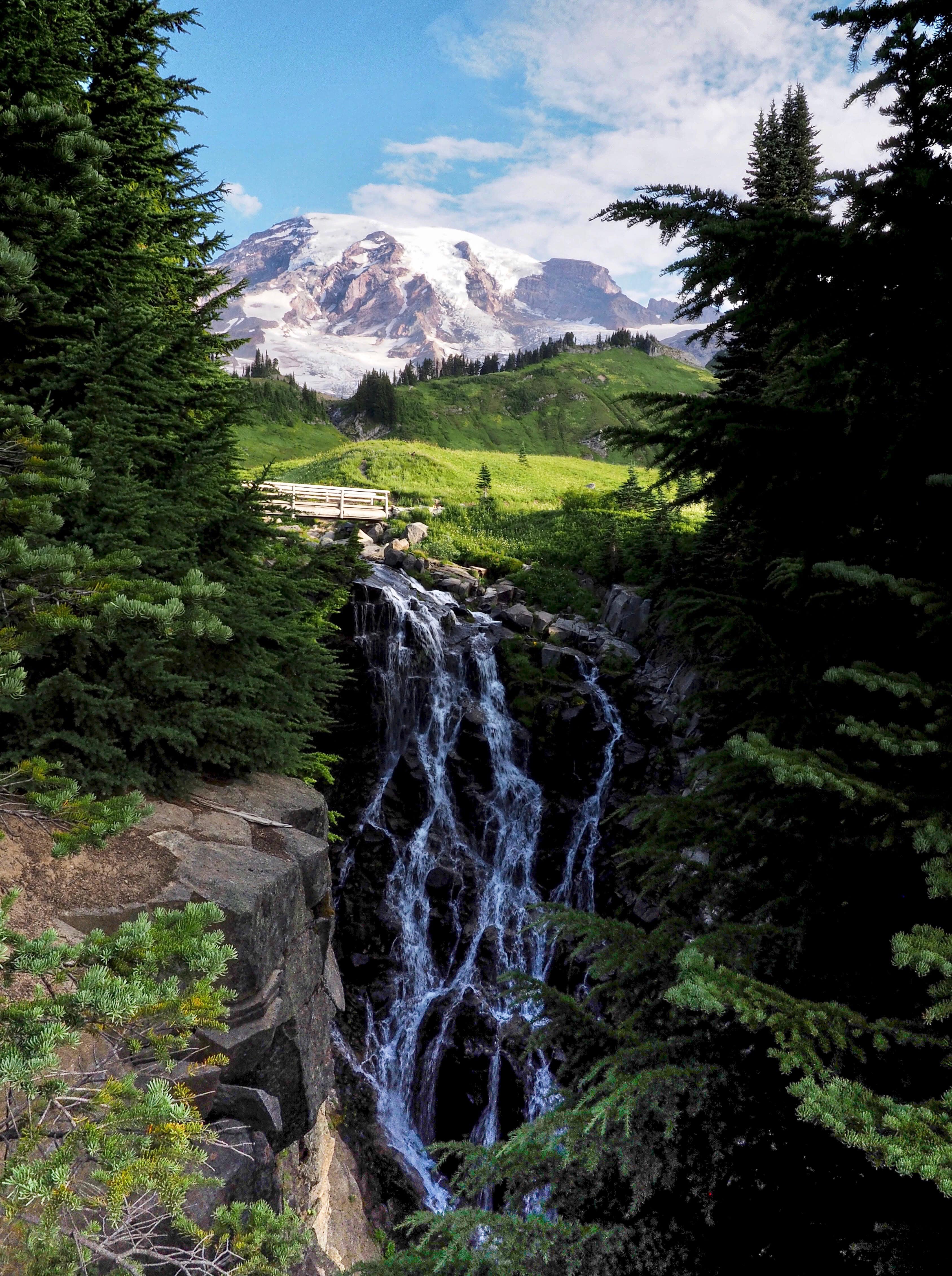
The Skyline trail network explores the alpine uplands just beyond Mt. Rainier’s treeline. Here, Edith Creek’s Myrtle Falls tumbles from the snow-fed meadowland just beyond. Skyline Trail, Mt. Rainier National Park, Washington.
The Skyline Trail forms the backbone of a trail network that crisscrosses Mt. Rainier National Park’s upper Paradise area. This is a land of big views skimming peaks, valleys, glaciers, and newborn rivers, as well as glimpses of the flora and fauna that exist at the edge of life on the Cascades’ highest peak. Eleven side trails vary the hiking terrain from forest shadows to stony heights. Between those extremes, a ribbon of verdant alpine meadows hems the frontier with a kaleidoscopic display of summertime wildflowers. Together, these features forge the unique landscape that is Paradise.
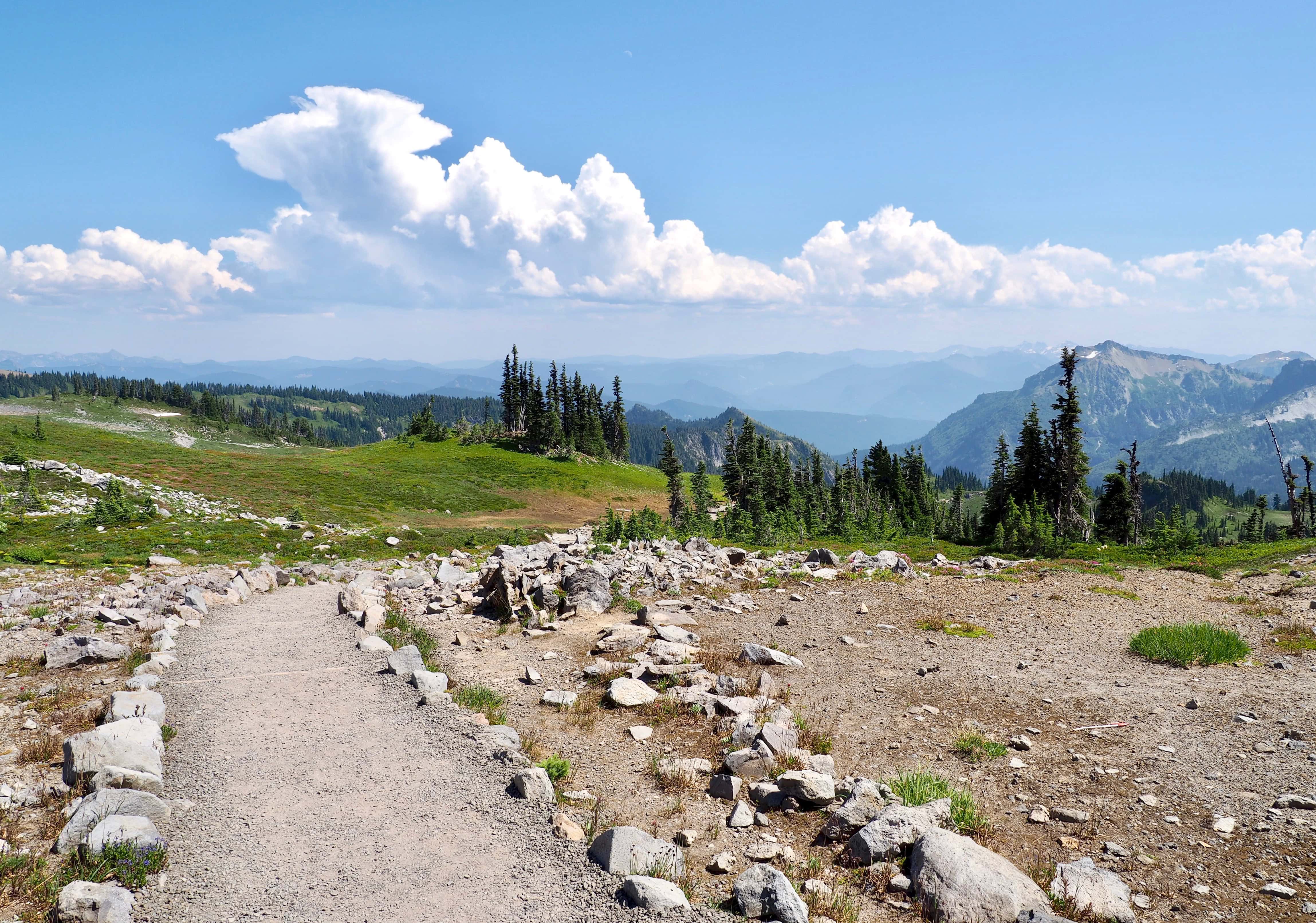
The Skyline Trail itself is a loop that climbs — sometimes steeply — from several trailheads at the Paradise Jackson Visitor Center and Paradise Inn and, at its farthest, arcs just below the common climbing route to Mt. Rainier’s summit before descending back to the trailheads. The separately named side trails provide options for lengthening or shortening the hike, as do the connecting and equally scenic Lakes and High Lakes trails that ring lower Paradise. Furthermore, the Nisqually Vista Trail, Alta Vista Trail, and lower portions of the Skyline Trail are paved or gravelled, increasing accessibility to hikers of various abilities. The best way to choose your route is to consult the Park Service’s handy trail map at one of the “Additional Trail Info” links above.
Despite their ease of access, the trails immerse hikers in wilderness immediately. Wildlife is easily spotted, mostly deer and various smaller creatures, but sometimes also species as large as bears and mountain goats. Although quite accustomed to humans, the animals are not tame and should not be fed or approached. And, resist the urge to leave the clearly designated trails to snap that perfect photo, as the alpine ecosystem is delicate and, in the austere mountaintop climate, takes years to recover from damage inflicted by trampling feet. Do expect to share the trails with other hikers, especially near the visitor center and inn, and enjoy snippets of conversation in accents and languages from around the world. Finally, be prepared for sudden changes in the fickle mountain weather and for snow lingering on the trails well into summer. At the “Additional Trail Info” links above, check out the National Park Service’s site for the current Mt. Rainier weather forecast and the Washington Trails Association’s site for trip reports on recent trail conditions.
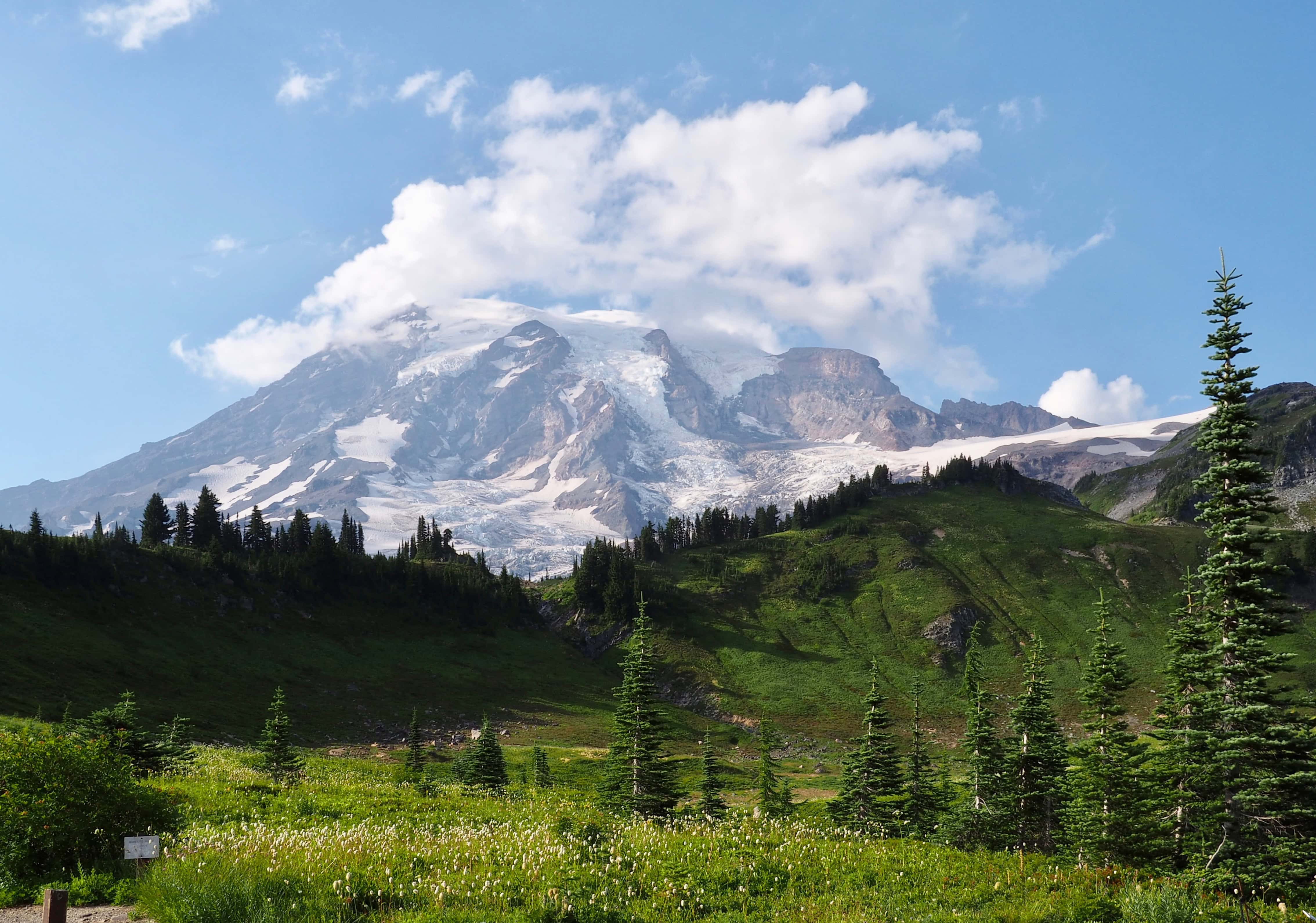
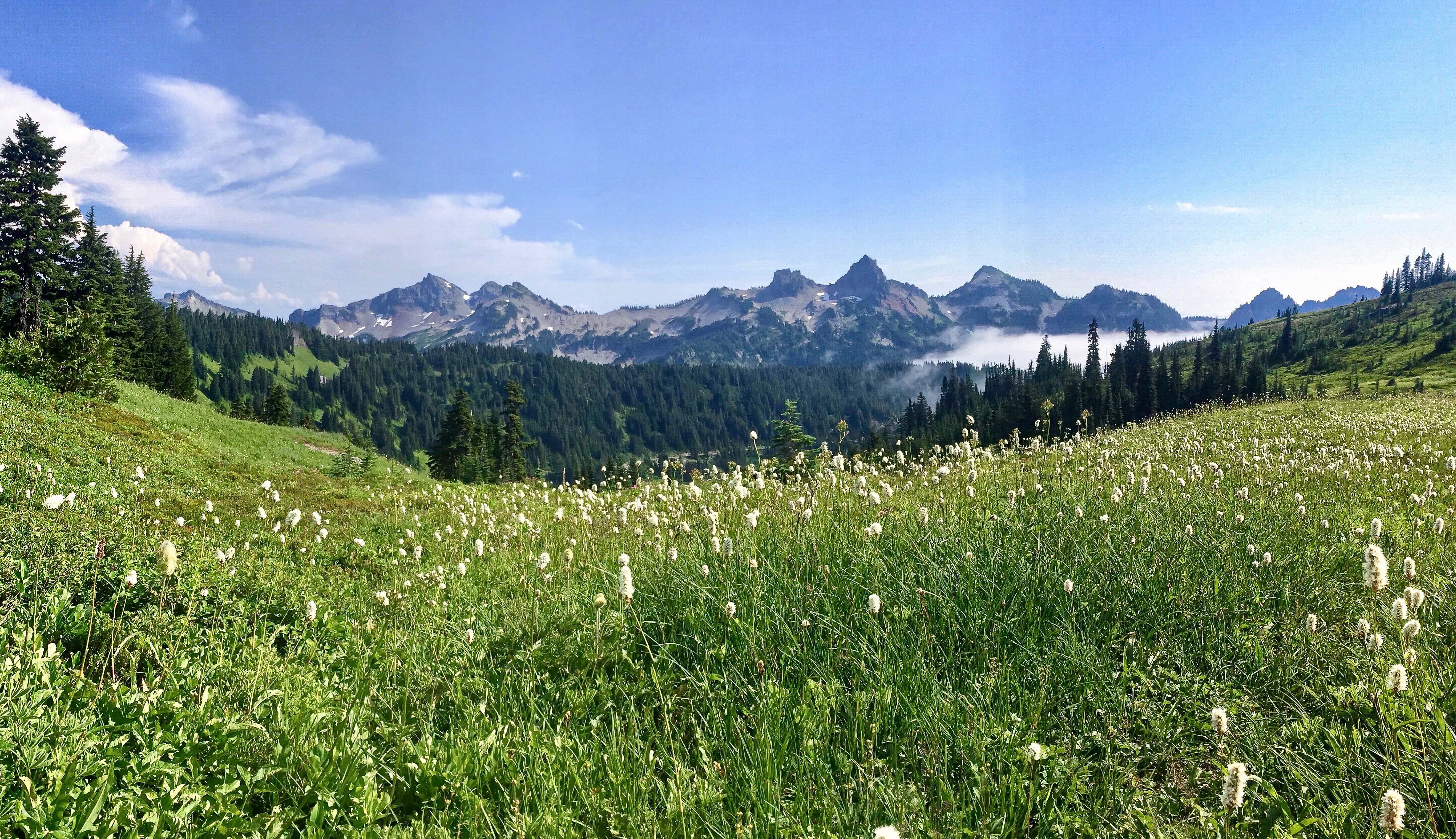
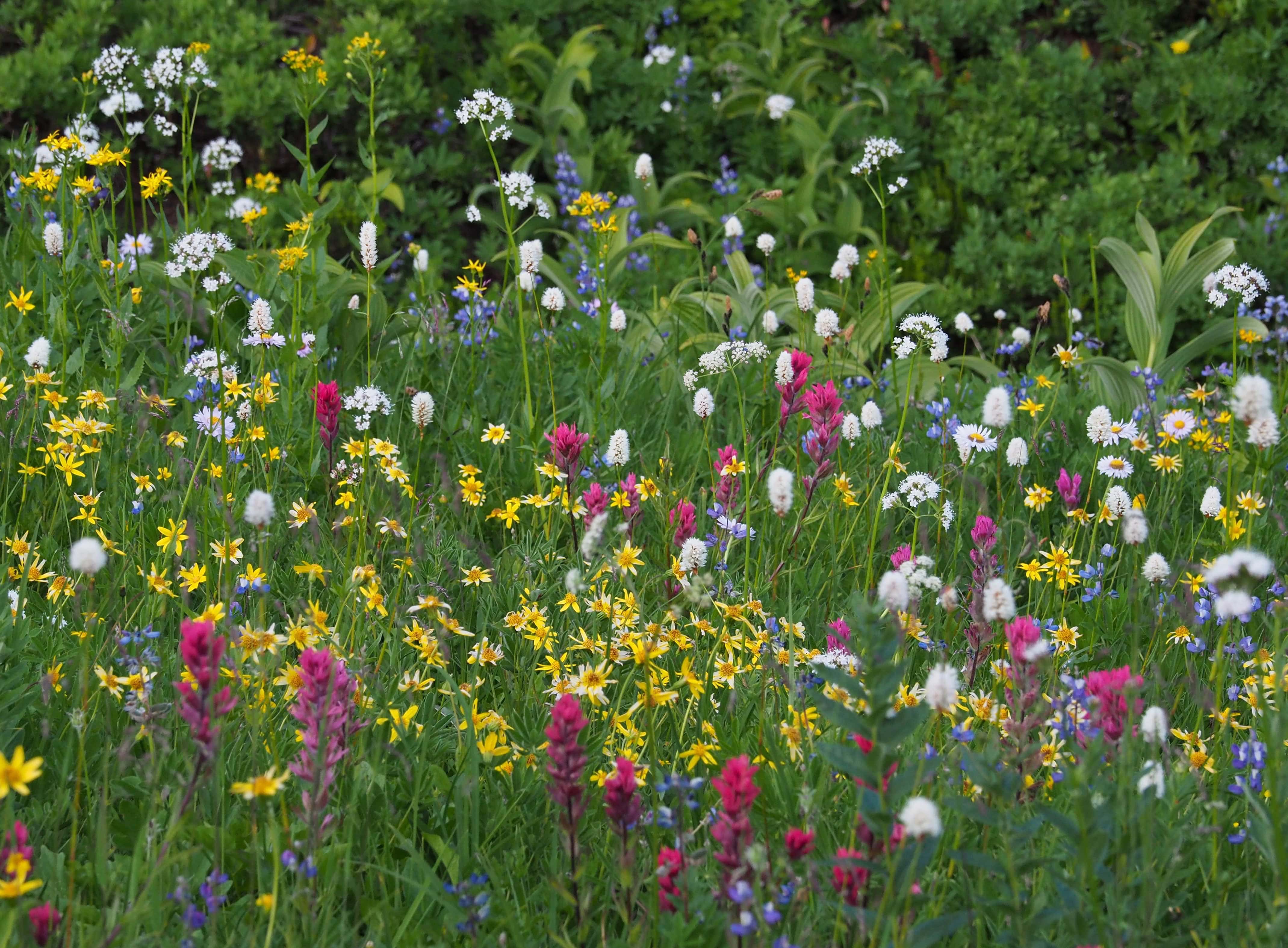
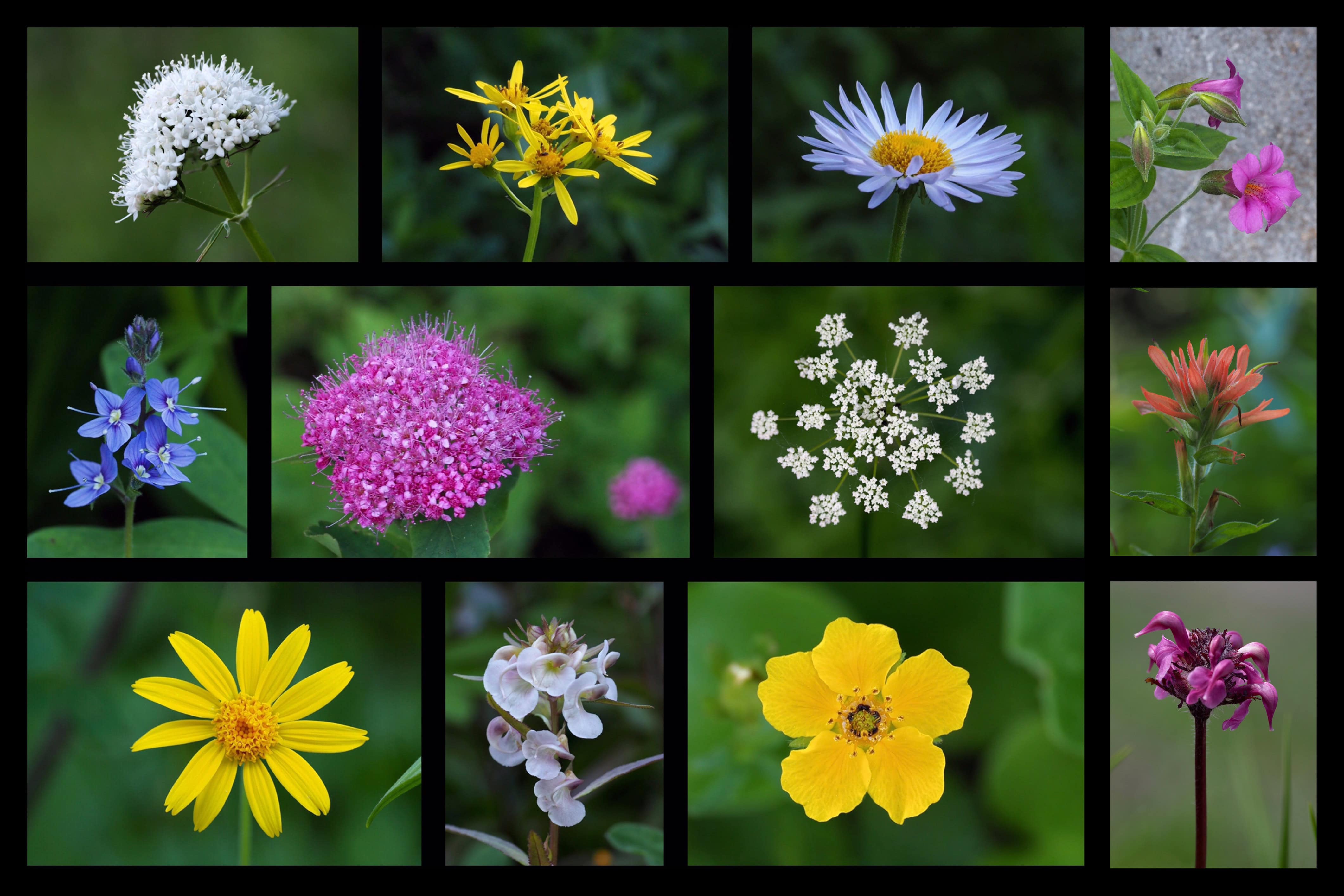
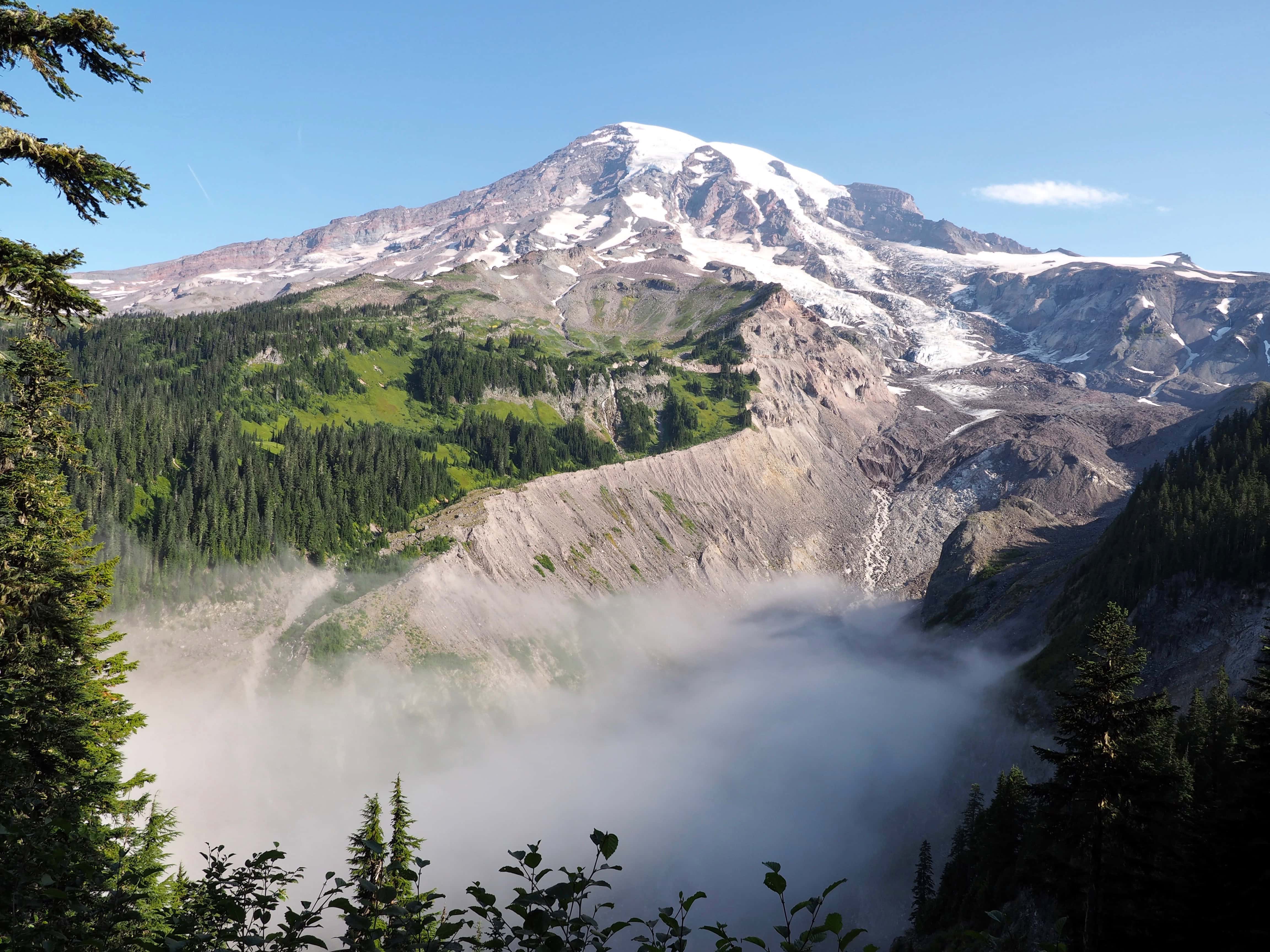
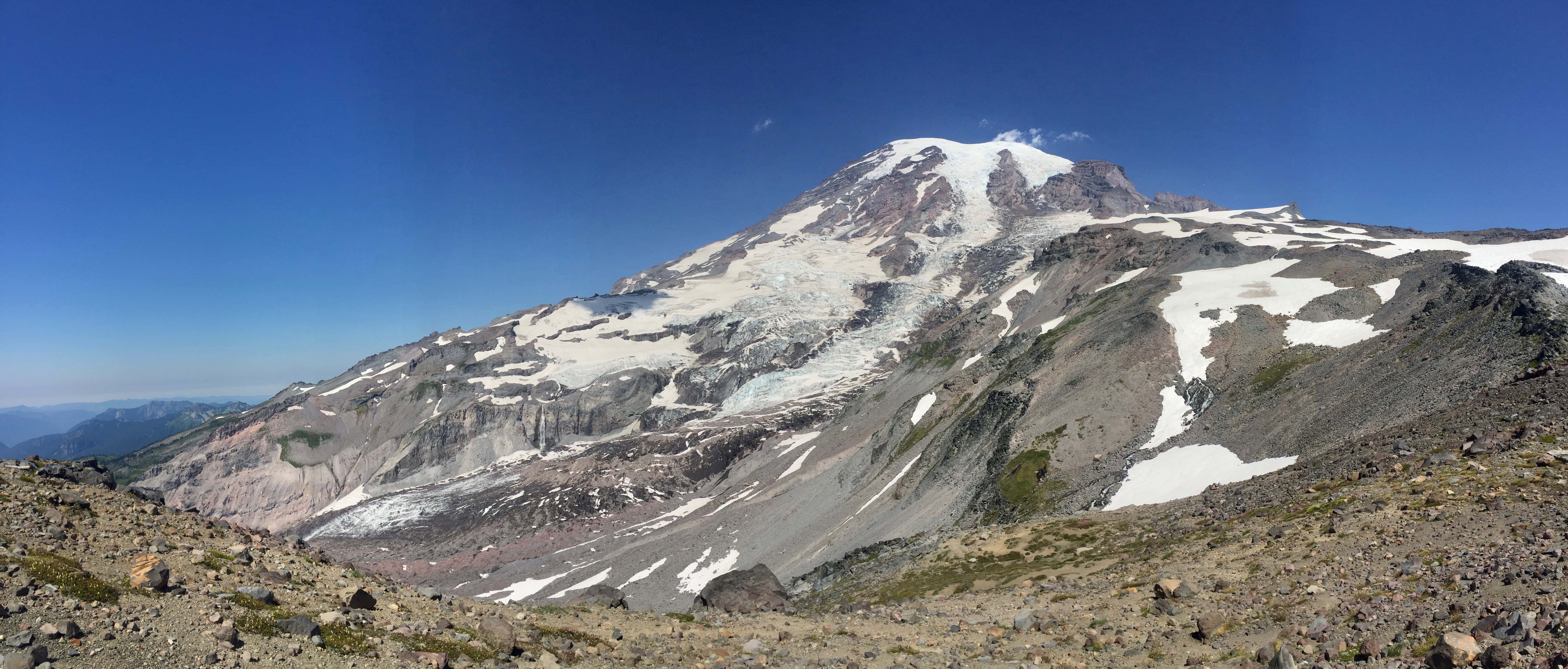
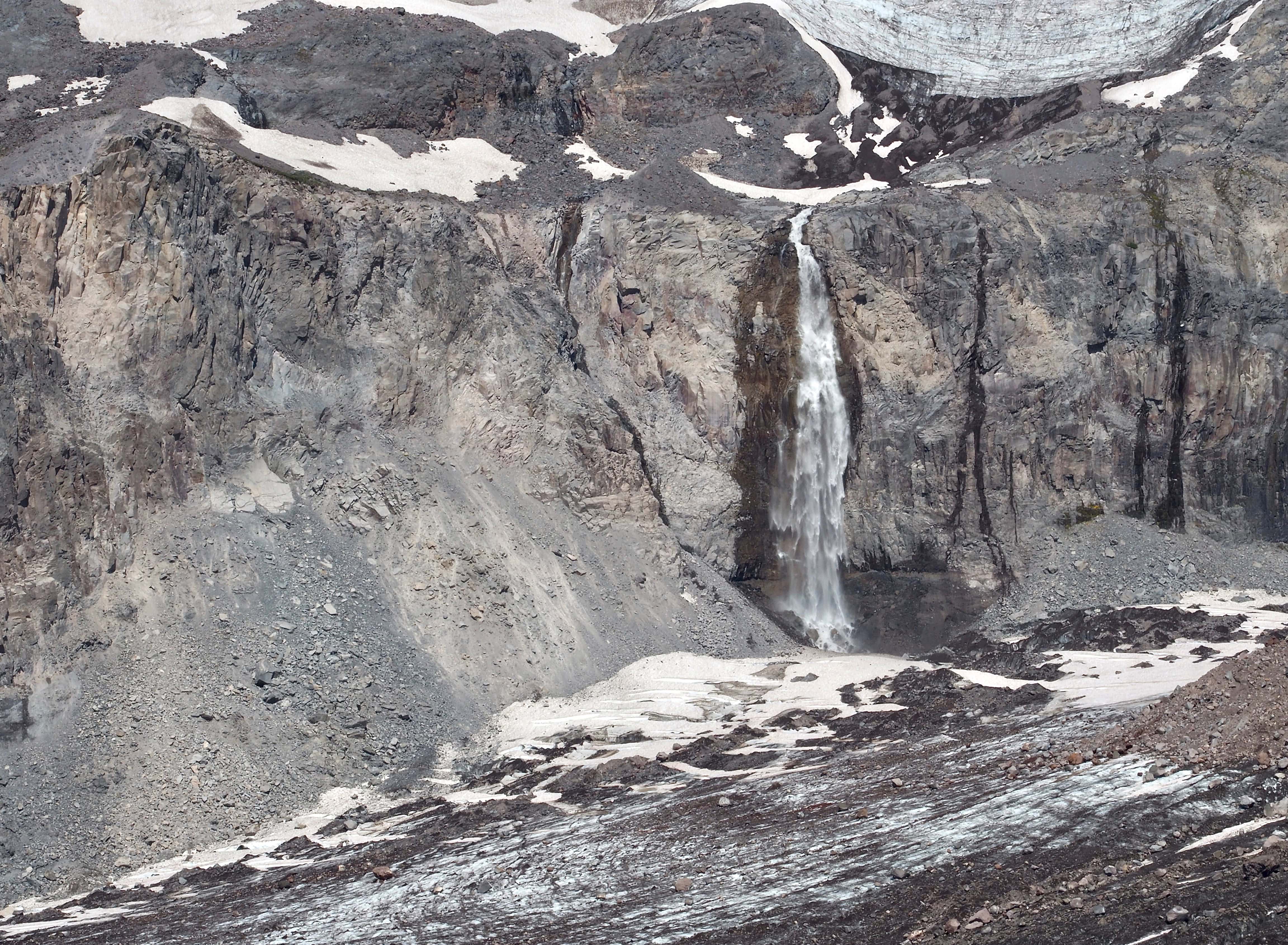
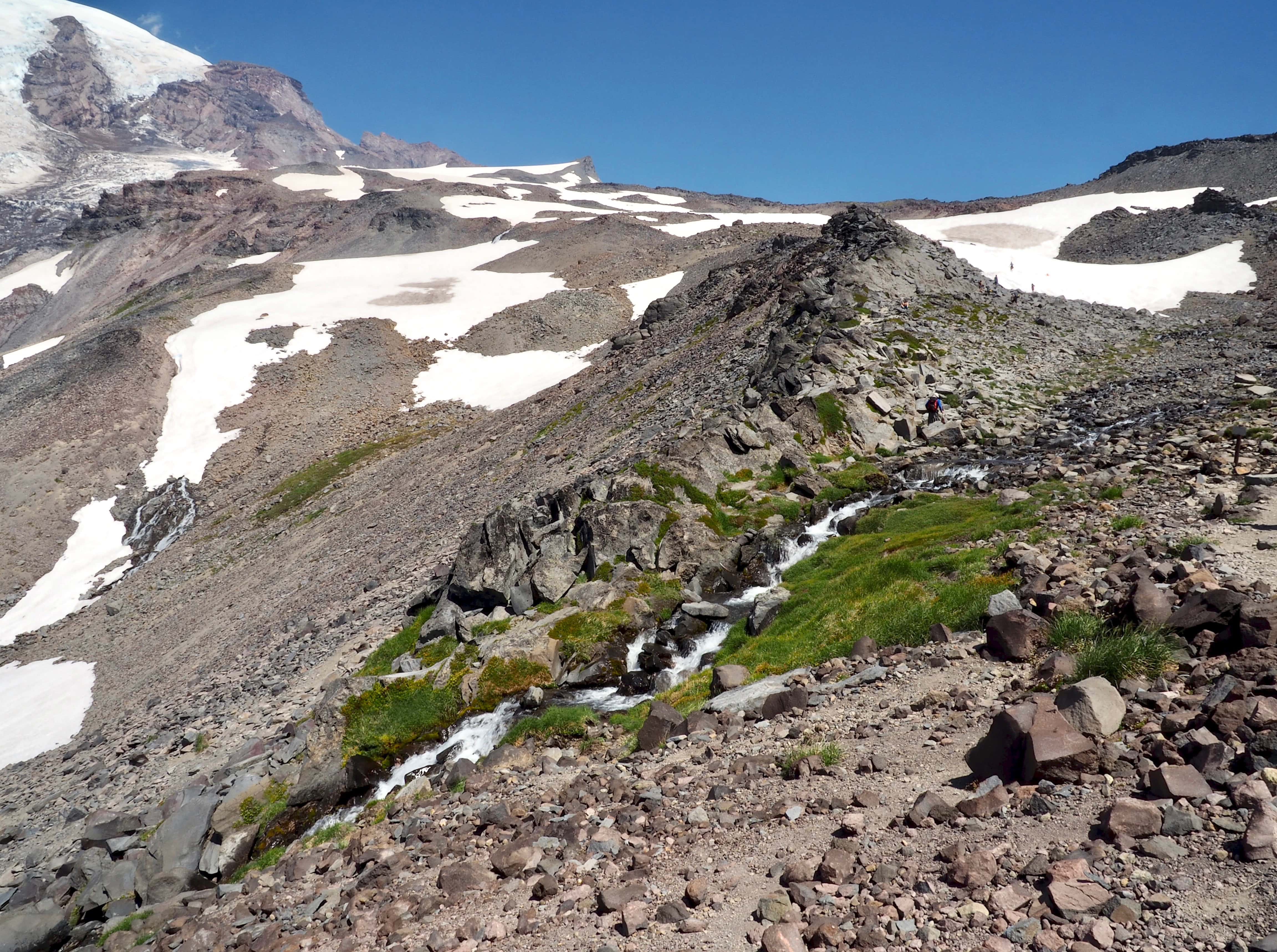
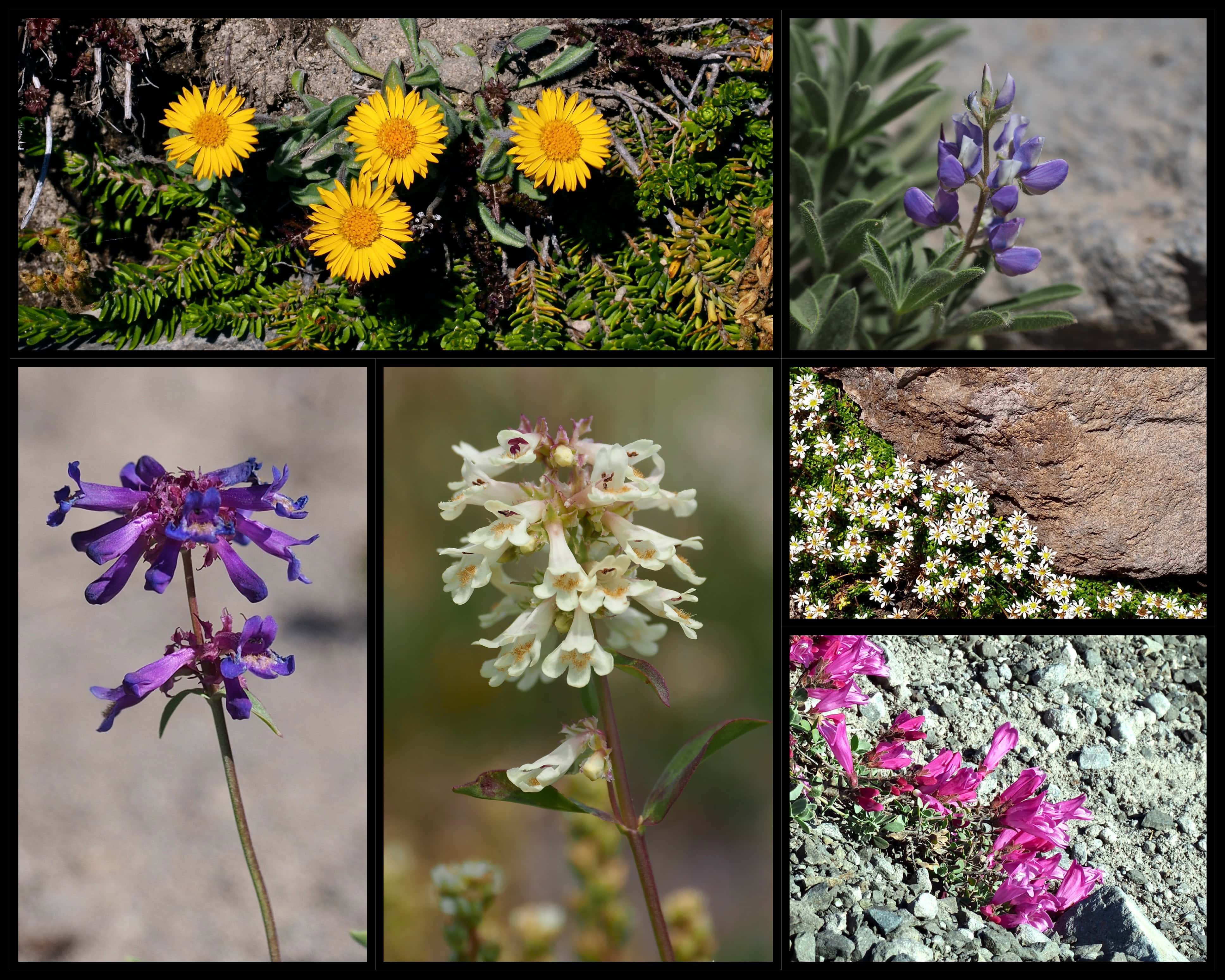
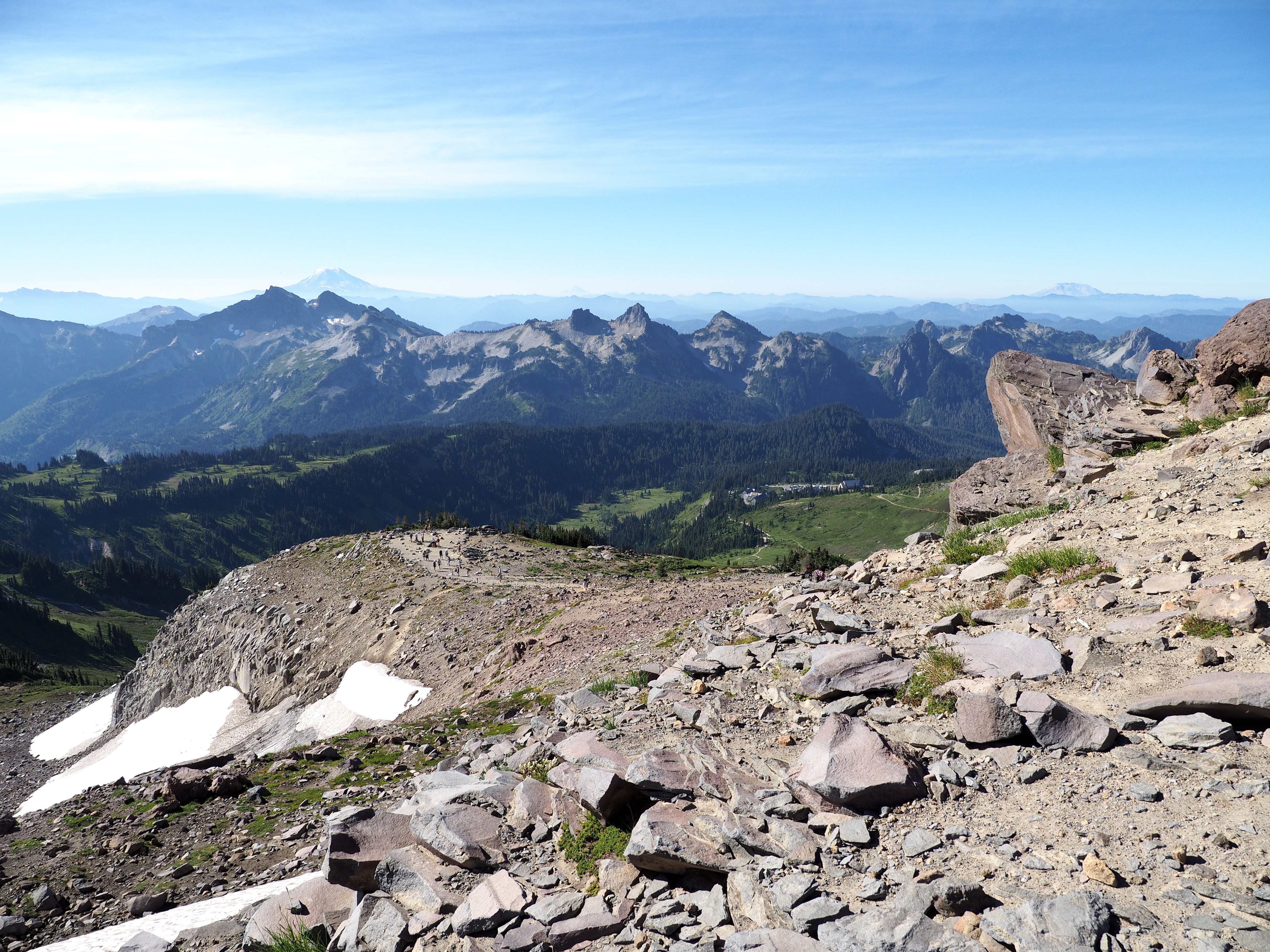
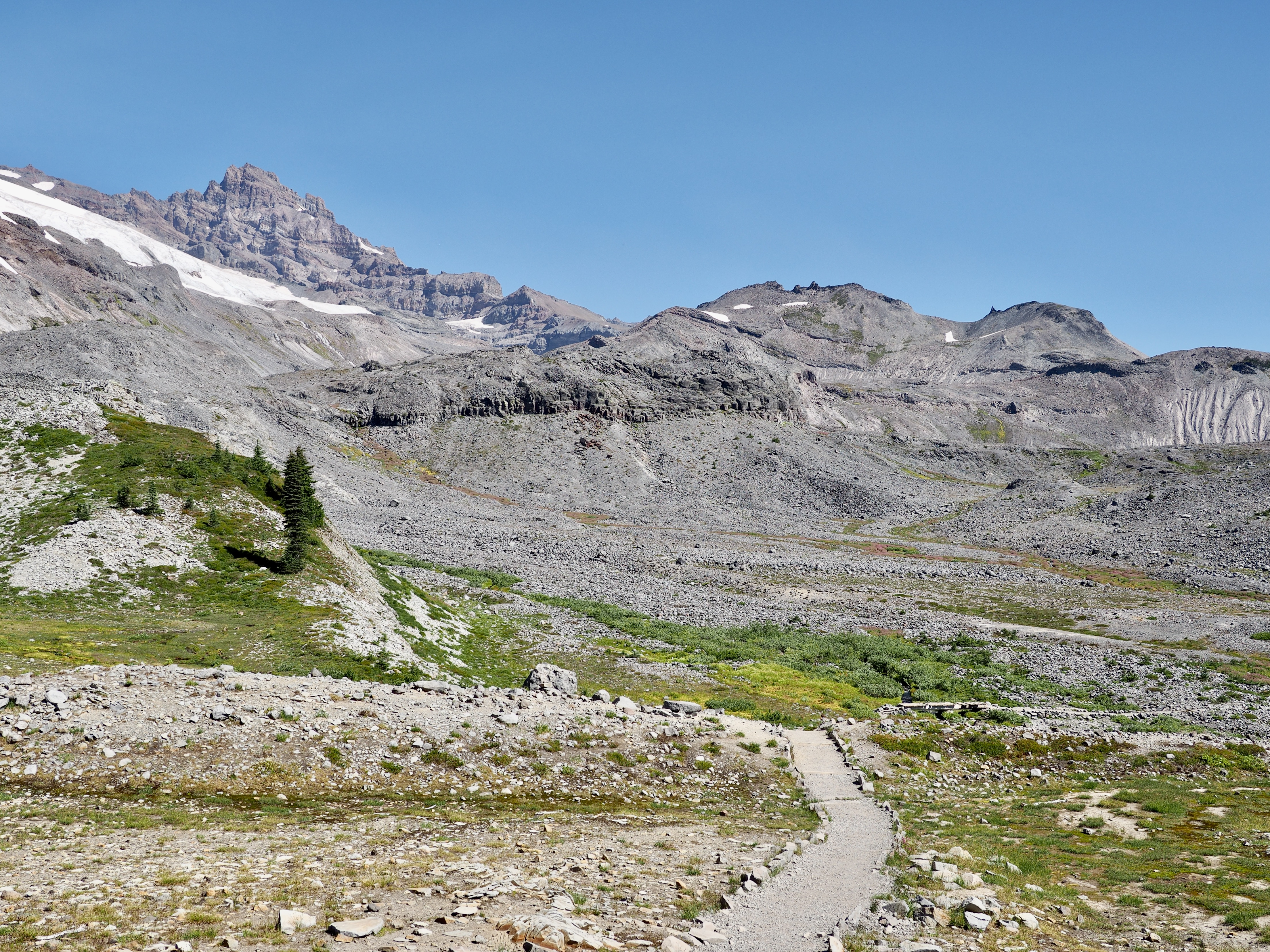
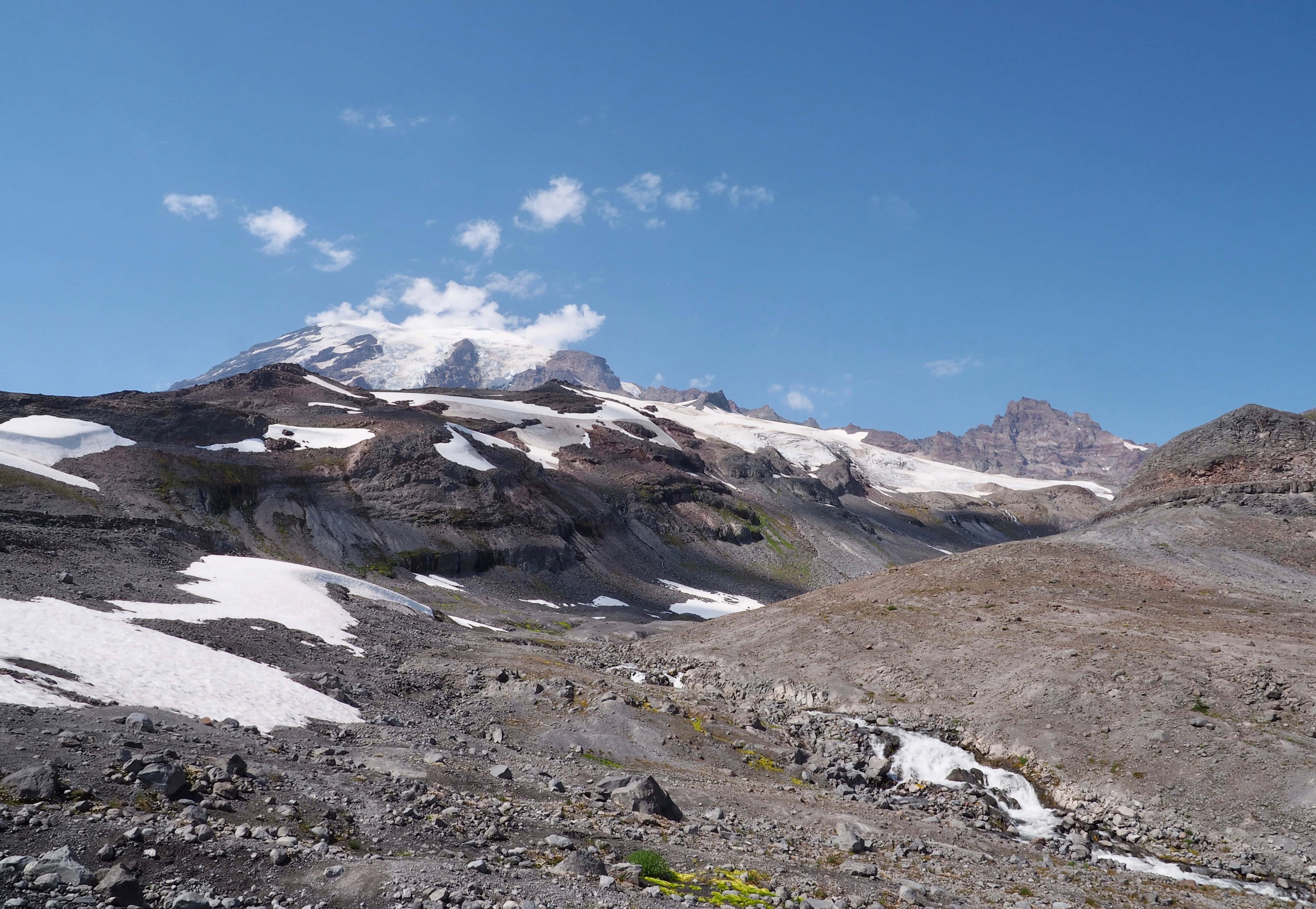
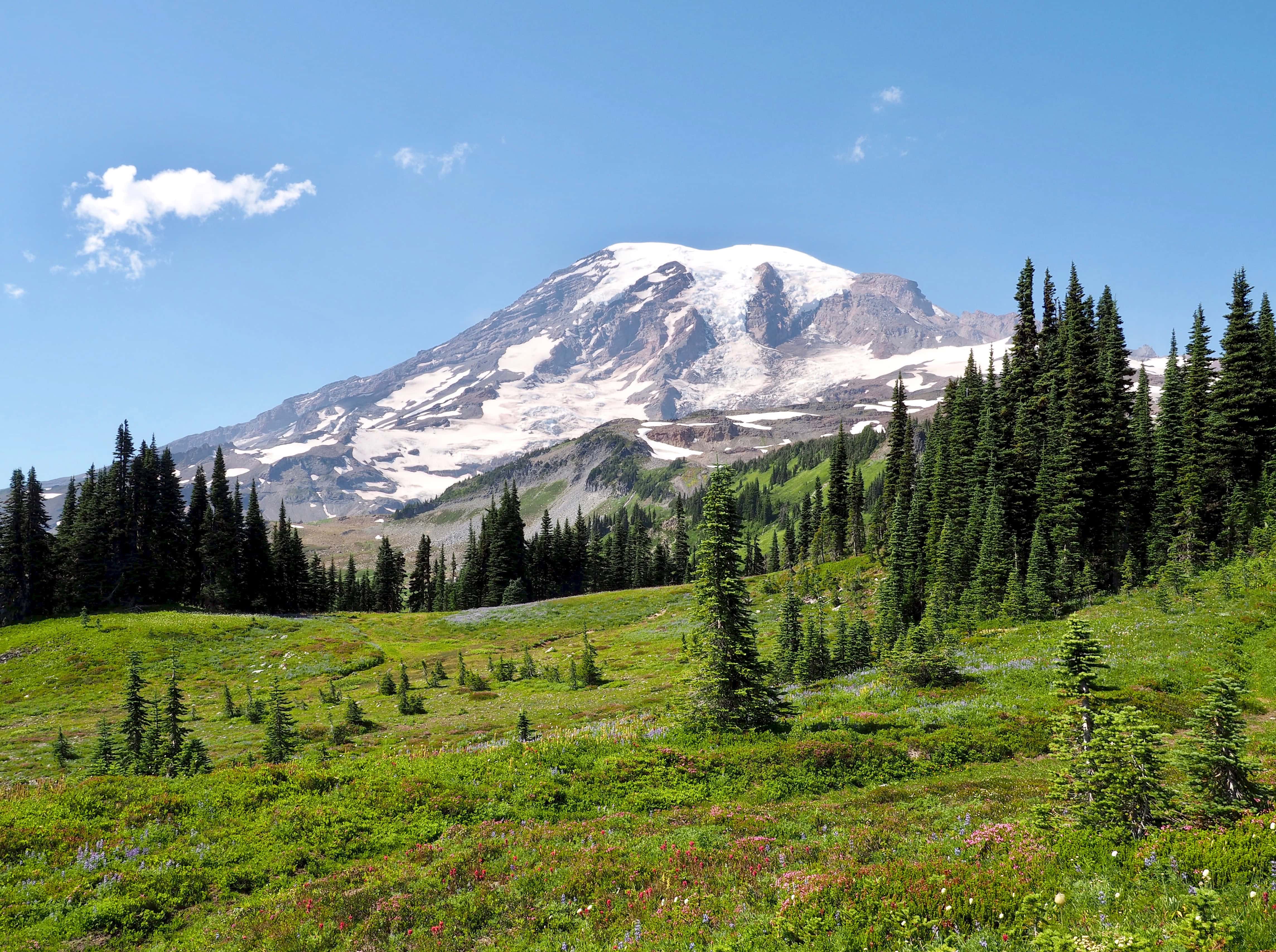
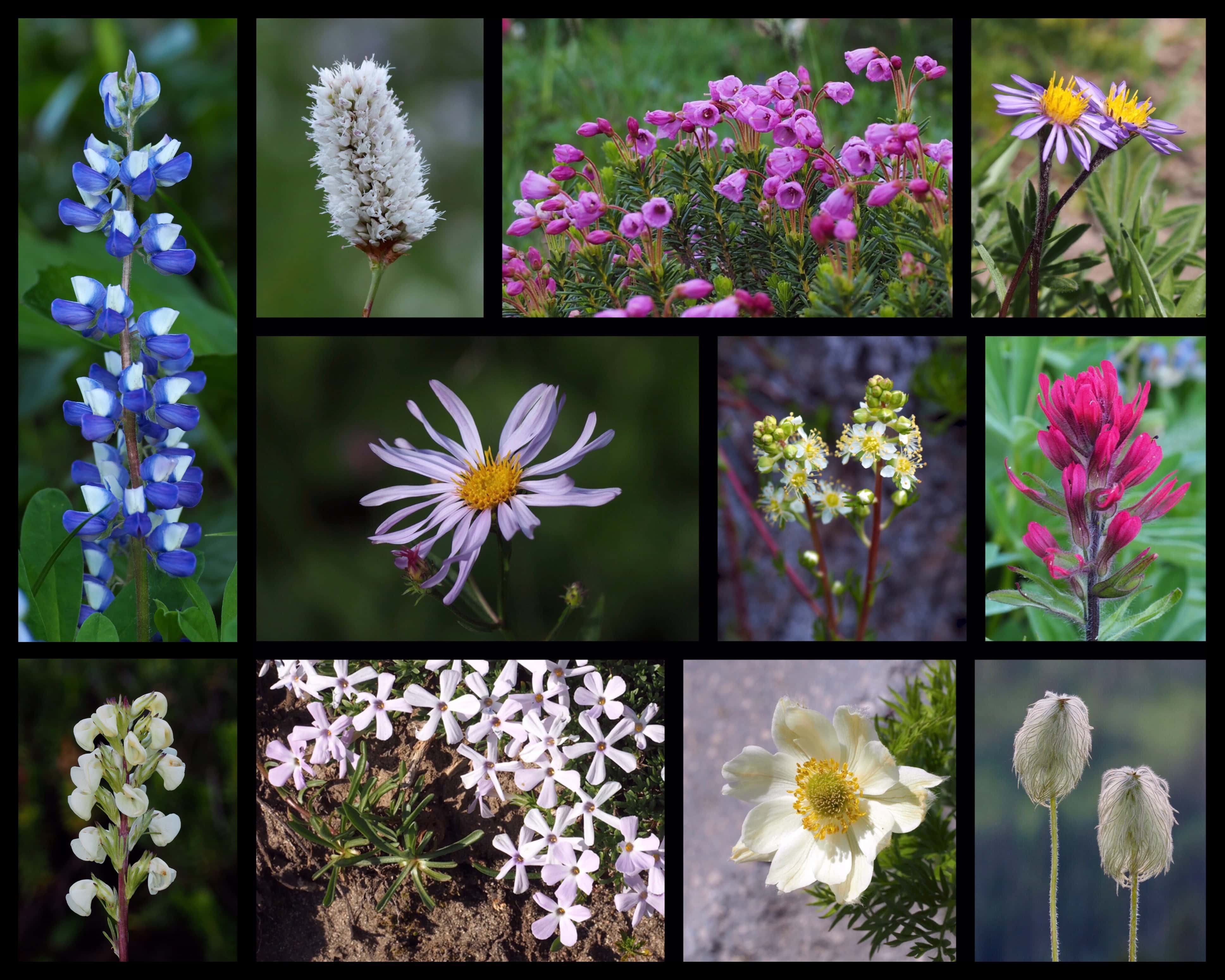
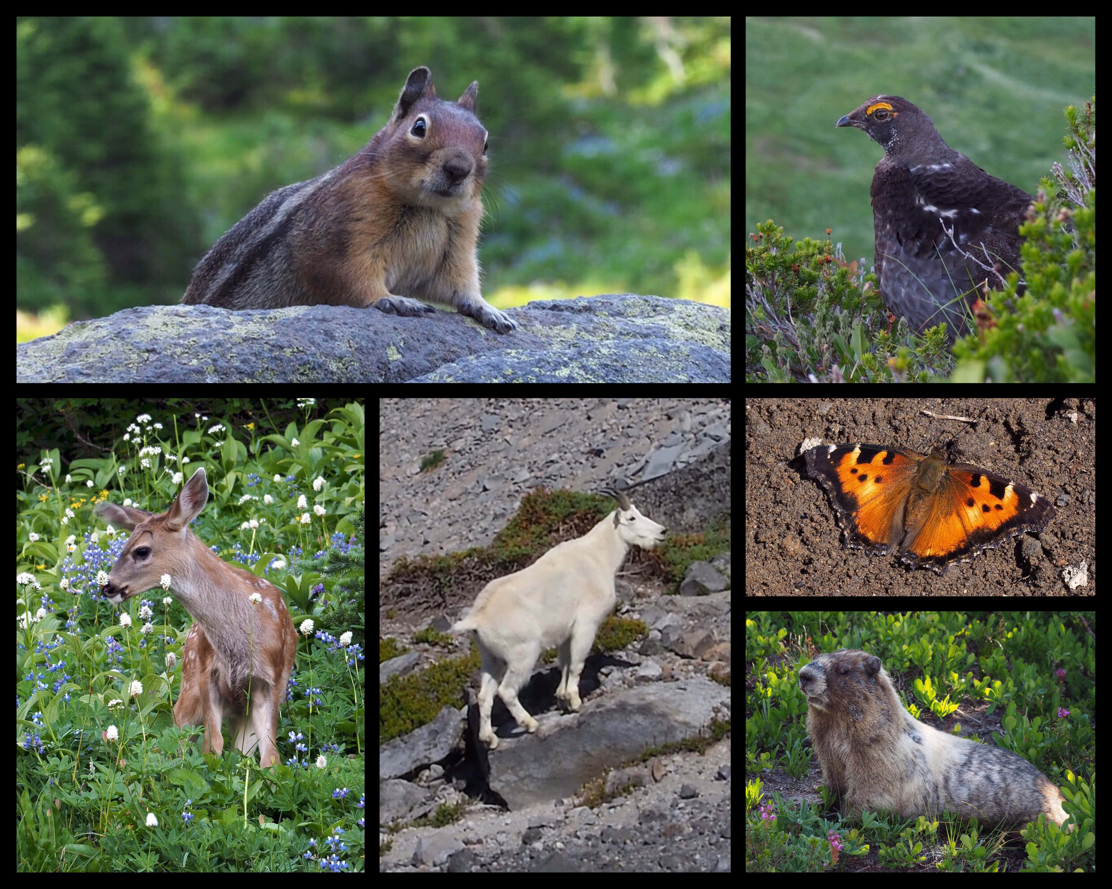
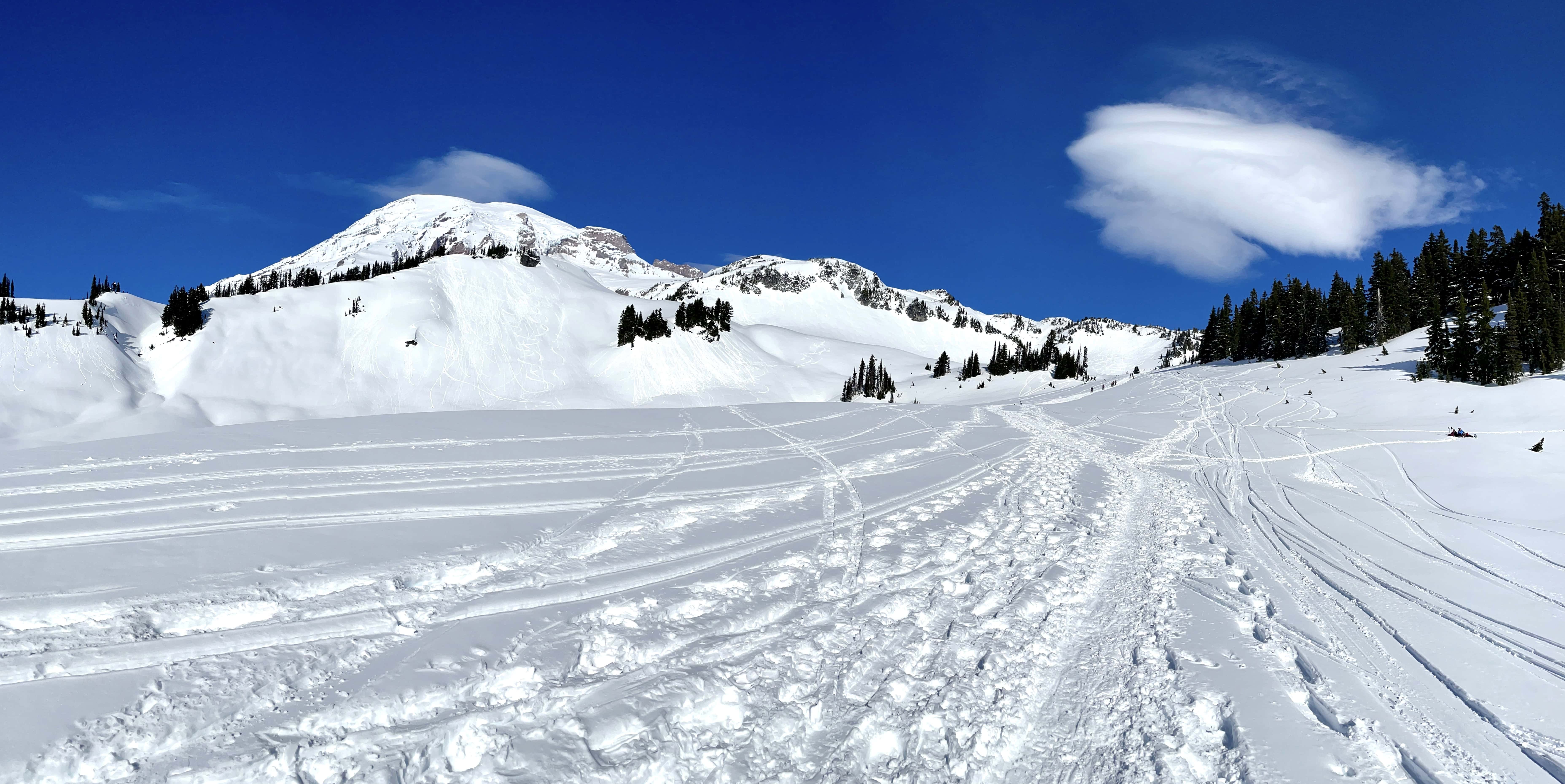
Although the Skyline trail complex offers routes with varying round-trip distances and elevation gains, it also provides spectacular mountain and meadow views from even the paved and gravelled trails near the Paradise Jackson Visitor Center and Paradise Inn. This photo was taken near Myrtle Falls at the junction of the Skyline Trail’s paved section with the unpaved Golden Gate Trail. Skyline Trail, Mt. Rainier National Park, Washington.Opposite Mt. Rainier, the Tatoosh Range rears its many peaks along the southern horizon from most vantages throughout the Skyline trail complex. Golden Gate Trail, Mt. Rainier National Park, Washington.At lower elevations, parti-colored wildflowers throng the trailsides throughout Paradise during the summer months. Alta Vista Trail, Mt. Rainier National Park, Washington.Look for an abundant variety of wildflowers that thrive along seeps and shaded meadow fringes, including, upper row, left to right, Sitka valerians (Valeriana sitchensis), arrowleaf groundsels (Senecio triangularis), subalpine fleabanes (Erigeron glacialis var. glacialis), and purple monkey-flowers (Erythranthe lewisii); center row, left to right, Cusick’s speewells (Veronica cusickii), subalpine spiraeas (Spiraea splendens), lovage (Ligusticum spp.), and scarlet paintbrushes (Castilleja miniata); and lower row, left to right, various arnicas (Arnica spp.), sickletop louseworts (Pedicularis racemosa), high mountain cinquefoils (Potentilla flabellifolia), and bird’s beak louseworts (Pedicularis ornithorhyncha). Alta Vista, Nisqually Vista, Paradise Glacier, and Skyline trails, Mt. Rainier National Park, Washington.The western portion of the Skyline Trail and its several side trails offer expansive views of the Nisqually Glacier and the vast furrow it has gouged into the mountainside at the head of the Nisqually River. The short (and also fully paved) Nisqually Vista Trail offers forest-fringed views directly up the glacier’s maw. Nisqually Vista Trail, Mt. Rainier National Park, Washington.Climbing north, the Skyline, Moraine, Glacier Vista, and Pebble Creek trails offer increasingly expansive views of Mt. Rainier and the harsh mountaintop environment just steps beyond the burgeoning meadows below. Skyline Trail, Mt. Rainier National Park, Washington.Witness the birth of a river from the Skyline, Glacier Vista, and Pebble Creek trails as this massive waterfall — barely visible in the foregoing photo — courses off the Wilson Glacier onto the receding tip of the Nisqually Glacier below, scattered with debris the ice has scoured from the mountainside. The two glaciers are the headwaters of the Nisqually River. Glacier Vista Trail, Mt. Rainier National Park, Washington.An unassuming wet spot at 7,200 feet/2,195 meters in elevation, Pebble Creek is the highest point one can easily day hike from Paradise without traction gear and skill in traversing alpine terrain. Camp Muir, which serves as a base camp for many climbers summitting Mt. Rainier, lies over 2.00 miles/3.00 km and almost 3,000 feet/914 meters up the Muir Snowfield, which commences just beyond Pebble Creek. (For a sense of scale, note the climbers in this photo dotting the snowfield above Pebble Creek.) Pebble Creek Trail, Mt. Rainier National Park, Washington.In the extreme upper limits of meadow life on the mountainside, look for tiny blooms sprouting from mats of foliage among the stones, called fellfields. These alpine miniatures include, clockwise from top left, golden fleabanes, or, alpine gold daisies (Erigeron aureus), Pacific lupines (Lupinus lepidus), alpine saxifrages (Micranthes tolmiei), cliff beardtongues (Penstemon rupicola), and both the white and purple forms of Tolmie’s penstemon (Penstemon procerus var. tolmiei). Skyline, High Skyline, Pebble Creek, and Paradise Glacier trails, Mt. Rainier National Park, Washington.Near the side trail to Pebble Creek, Panorama Point lives up to its name with 360-degree views telescoping out to points as distant as Oregon. Just above the treeline, Panorama Point (seen here in the left foreground) gazes across Paradise to the Tatoosh Range on the park’s southern border. On a clear day, three of Mt. Rainier’s neighboring volcanoes float atop the horizon beyond: Mt. Adams (left), Mt. Hood (center), and Mt. St. Helens (right). Panorama Point is easily accessed just off the western portion of the Skyline Trail between its lower and upper junctions with the Pebble Creek Trail. The section of the Skyline Trail that curves above Panorama Point beyond the Pebble Creek Trail is sometimes called the High Skyline Trail. Skyline Trail, Mt. Rainier National Park, Washington.On a clear day, the vast alpine barrens along the Skyline Trail’s upper east section afford sweeping vistas of other geologic features, such as Little Tahoma (left) and Cowlitz Rocks (right). Skyline Trail, Mt. Rainier National Park, Washington.The 0.75-mile/1.20-km Paradise Glacier side trail leads to a secluded moraine valley carved by the glacier of the same name. Paradise Glacier has retreated beyond sight of the end of the maintained trail, which nevertheless offers opportunity to observe the desolate, otherworldly environment at the top of the world, as well as the nascent Paradise River coursing from its birthplace just above. Paradise Glacier Trail, Mt. Rainier National Park, Washington.The Skyline Trail’s eastern highlands skirt the headwall of Stevens Canyon, offering a glimpse of the full view to be had from the connecting Lakes Trail that continues to the southern half of Paradise. Skyline Trail, Mt. Rainier National Park, Washington.The Skyline Trail’s eastern section traverses massive meadows under Mt. Rainier’s ever-present gaze. The Lakes Trail diverges from the Skyline Trail approximately 1.40 miles/2.25 km from the Paradise Inn and Paradise Jackson Visitor Center and continues southward with similarly spectacular views. Skyline Trail, Mt. Rainier National Park, Washington.Additional wildflowers teem the sunny upland meadows throughout Paradise, including, top row, left to right, broadleaf lupines (Lupinus latifolius var. subalpinus), alpine, or, American bistorts (Bistorta bistortoides), pink mountain-heaths (Phyllodoce empetriformis), and tundra asters (Oreostemma alpigenum); center row, middle left to right, Cascade asters (Eucephalus ledophyllus), partridgefoots (Luetkea pectinata), and small-flowered, or, magenta paintbrushes (Castilleja parviflora var. oreopola); and lower row, left to right, white-coiled louseworts (Pedicularis contorta), spreading phlox (Phlox diffusa), and western pasqueflowers (Anemone occidentalis) (shown here both in bloom and after bloom as distinctively maned seed heads). Alta Vista and Skyline trails, Mt. Rainier National Park, Washington.A variety of wildlife can also be seen along the Skyline trail complex, including, clockwise from upper left, Cascade golden-mantled ground squirrels (Callospermophilus saturatus), sooty grouse (Dendragapus fuliginosus), California tortoiseshell butterflies (Nymphalis californica), hoary marmots (Marmota caligata), mountain goats (Oreamnos americanus), and black-tailed deer (Odocoileus hemionus columbianus). Skyline, Alta Vista, and Pebble Creek trails, Mt. Rainier National Park, Washington.In winter, many of the trails around Paradise are suitable for snowshoeing. Do be sure to check the mountain weather forecast and road conditions beforehand, equip yourself with appropriate winter gear, follow all Park regulations, and avoid avalanche-prone slopes (even small ones — it doesn’t take much snow to bury a human!). Golden Gate Trail, Mt. Rainier National Park, Washington.